Aquiles Serdán geodata
Aquiles Serdán (Chiapas) is a populated place; located in Mexico in America/Mexico_City (GMT-6) time zone. With population of 996 people, there are 8744 cities with bigger population in this country. Compared to other cities in Mexico, 99.1% of cities are located further ↑North; 92.1% of cities are located further ←West and 84.1% of cities have higher elevation than Aquiles Serdán. Note1


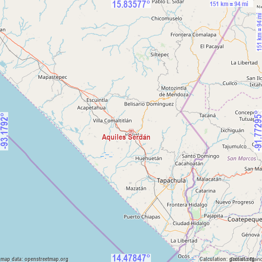
Aquiles Serdán GPS coordinates[2]
15° 9' 29.556" North, 92° 28' 33.852" West
| Map corner | latitude | longitude |
|---|---|---|
| Upper-left | 15.83577°, | -93.1792° |
| Center: | 15.15821°, | -92.47607° |
| Lower-right: | 14.47847°, | -91.77295° |
| Map W x H: | 150.9×150.9 km | = 93.8×93.8mi |
| max Lat: | 32.7° ⇑99.1% North |
| Aquiles Serdán: | 15.15821° |
| min Lat: | ⇓0.9% South 14.53588° |
| min Long | Aquiles Serdán | max Long |
| -117.105° | -92.47607° | -86.73105° |
| W 92.1%⇐ | ⇒7.9% E |
Elevation
Elevation of Aquiles Serdán is 51 m = 167 ft, and this is 1202.7 m = 3946 ft below average elevation for this country.
| Max E: |
3497 m = 11473 ft | 84.1% |
| Avg. | 1253.7 m = 4113 ft | |
| Aquiles Serdán | 51 m = 167 ft | |
Min E: |
-1 m = -3 ft | 15.9% |
See also: Mexico elevation on elevation.city.
Geographical zone
Aquiles Serdán is located in North Torrid zone (between Equator and Tropic of Cancer). Distance of this Northern Tropic circle is 920.5 km =572 mi to North.| Distance of | km | miles | from Aquiles Serdán |
|---|---|---|---|
| North Pole | 8321.6 | 5170.8 | to North |
| Arctic Circle | 5715.7 | 3551.6 | to North |
| Tropic Cancer | 920.5 | 572 | to North |
| Equator | 1685.4 | 1047.3 | to South |


Nearby cities:
15 places around Aquiles Serdán: (largest is in red/bold)
• Cantón Playa Grande
6.6 km =4.1 mi,  223°
223°
• Cantón las Delicias
6.7 km =4.2 mi,  202°
202°
• Colonia Obrera
7.1 km =4.4 mi, 199°
• El Chipilín
6.7 km =4.2 mi,  128°
128°
• El Retiro
7.5 km =4.7 mi,  45°
45°
• Estación Tuzantán
6.4 km =4 mi,  154°
154°
• Guadalupe Victoria
7.6 km =4.7 mi,  85°
85°
• Huixtla
2.5 km =1.6 mi, 148°
• La Flor
3.8 km =2.4 mi,  108°
108°
• Nueva Tenochtitlán
7.7 km =4.8 mi,  58°
58°
• Nuevo Brasil
7.6 km =4.7 mi,  305°
305°
• Primer Cantón
5.7 km =3.5 mi,  137°
137°
• Tuzantán
5.9 km =3.7 mi,  102°
102°
• Veintinueve de Diciembre
3.1 km =1.9 mi,  121°
121°
• Xochiltepec
5.7 km =3.5 mi, 126°
Sources, notices
• [Note1] Compared only with cities in Mexico existing in our database
• [Src1] Map data: © OpenStreetMap contributors (CC-BY-SA)
• [Src2] Other city data from geonames.org with taken over terms of usage.
• [Src3] Geographical zone / Annual Mean Temperature by Robert A. Rohde @ Wikipedia
