La Flor geodata
La Flor (Chiapas) is a populated place; located in Mexico in America/Mexico_City (GMT-6) time zone. With population of 598 people, there are 14373 cities with bigger population in this country. Compared to other cities in Mexico, 99.1% of cities are located further ↑North; 92.4% of cities are located further ←West and 78.2% of cities have higher elevation than La Flor. Note1


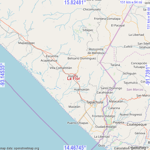
La Flor GPS coordinates[2]
15° 8' 49.992" North, 92° 26' 31.992" West
| Map corner | latitude | longitude |
|---|---|---|
| Upper-left | 15.82481°, | -93.14535° |
| Center: | 15.14722°, | -92.44222° |
| Lower-right: | 14.46745°, | -91.7391° |
| Map W x H: | 150.9×150.9 km | = 93.8×93.8mi |
| max Lat: | 32.7° ⇑99.1% North |
| La Flor: | 15.14722° |
| min Lat: | ⇓0.9% South 14.53588° |
| min Long | La Flor | max Long |
| -117.105° | -92.44222° | -86.73105° |
| W 92.4%⇐ | ⇒7.6% E |
Elevation
Elevation of La Flor is 126 m = 413 ft, and this is 1127.7 m = 3700 ft below average elevation for this country.
| Max E: |
3497 m = 11473 ft | 78.2% |
| Avg. | 1253.7 m = 4113 ft | |
| La Flor | 126 m = 413 ft | |
Min E: |
-1 m = -3 ft | 21.8% |
See also: Mexico elevation on elevation.city.
Geographical zone
La Flor is located in North Torrid zone (between Equator and Tropic of Cancer). Distance of this Northern Tropic circle is 921.7 km =572.7 mi to North.| Distance of | km | miles | from La Flor |
|---|---|---|---|
| North Pole | 8322.8 | 5171.5 | to North |
| Arctic Circle | 5717 | 3552.4 | to North |
| Tropic Cancer | 921.7 | 572.7 | to North |
| Equator | 1684.2 | 1046.5 | to South |


Nearby cities:
15 places around La Flor: (largest is in red/bold)
• Aquiles Serdán
3.8 km =2.4 mi,  288°
288°
• Cuarto Cantón
6.3 km =3.9 mi,  180°
180°
• El Chipilín
3.4 km =2.1 mi,  151°
151°
• El Retiro
6.7 km =4.2 mi,  15°
15°
• Estación Tuzantán
4.6 km =2.9 mi,  191°
191°
• Francisco Sarabia 1ra. Sección
4.4 km =2.7 mi,  71°
71°
• Guadalupe Victoria
4.3 km =2.7 mi, 65°
• Huixtla
2.5 km =1.6 mi,  249°
249°
• Manacal
7.8 km =4.8 mi, 66°
• Nueva Tenochtitlán
6 km =3.7 mi,  29°
29°
• Primer Cantón
3 km =1.9 mi, 175°
• Segundo Cantón
5.2 km =3.2 mi,  171°
171°
• Tuzantán
2.1 km =1.3 mi,  90°
90°
• Veintinueve de Diciembre
1.1 km =0.7 mi, 247°
• Xochiltepec
2.3 km =1.4 mi,  157°
157°
Sources, notices
• [Note1] Compared only with cities in Mexico existing in our database
• [Src1] Map data: © OpenStreetMap contributors (CC-BY-SA)
• [Src2] Other city data from geonames.org with taken over terms of usage.
• [Src3] Geographical zone / Annual Mean Temperature by Robert A. Rohde @ Wikipedia
