Hueyatenco geodata
Hueyatenco (State of Mexico) is a populated place; located in Mexico in America/Mexico_City (GMT-6) time zone. With population of 727 people, there are 12009 cities with bigger population in this country. Compared to other cities in Mexico, 67.3% of cities are located further ↑North; 63.6% of cities are located further →East and 74.5% of cities have lower elevation than Hueyatenco. Note1


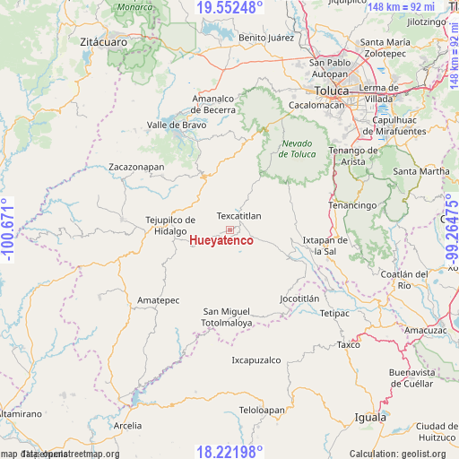
Hueyatenco GPS coordinates[2]
18° 53' 18.78" North, 99° 58' 4.332" West
| Map corner | latitude | longitude |
|---|---|---|
| Upper-left | 19.55248°, | -100.671° |
| Center: | 18.88855°, | -99.96787° |
| Lower-right: | 18.22198°, | -99.26475° |
| Map W x H: | 147.9×147.9 km | = 91.9×91.9mi |
| max Lat: | 32.7° ⇑67.3% North |
| Hueyatenco: | 18.88855° |
| min Lat: | ⇓32.7% South 14.53588° |
| min Long | Hueyatenco | max Long |
| -117.105° | -99.96787° | -86.73105° |
| W 36.4%⇐ | ⇒63.6% E |
Elevation
Elevation of Hueyatenco is 2022 m = 6634 ft, and this is 768.3 m = 2521 ft above average elevation for this country.
| Max E: |
3497 m = 11473 ft | 25.5% |
| Hueyatenco | 2022 m 6634 ft | |
| Avg. | 1253.7 m = 4113 ft | |
Min E: |
-1 m = -3 ft | 74.5% |
See also: Mexico elevation on elevation.city.
Geographical zone
Hueyatenco is located in North Torrid zone (between Equator and Tropic of Cancer). Distance of this Northern Tropic circle is 505.7 km =314.2 mi to North.| Distance of | km | miles | from Hueyatenco |
|---|---|---|---|
| North Pole | 7906.9 | 4913.1 | to North |
| Arctic Circle | 5301 | 3293.9 | to North |
| Tropic Cancer | 505.7 | 314.2 | to North |
| Equator | 2100.2 | 1305 | to South |


Nearby cities:
15 places around Hueyatenco: (largest is in red/bold)
• Acatitlán
4.2 km =2.6 mi,  25°
25°
• Almoloya de Alquisiras
8.1 km =5 mi,  108°
108°
• Capula
2.2 km =1.4 mi,  159°
159°
• Cuauhtenco
9.6 km =6 mi, 112°
• Diego Sánchez
6.9 km =4.3 mi,  165°
165°
• El Chapaneal
6.8 km =4.2 mi,  13°
13°
• Pantoja
5.4 km =3.4 mi,  255°
255°
• San Agustín
6.7 km =4.2 mi, 26°
• San Andrés Ocotepec
8.5 km =5.3 mi,  281°
281°
• San Andrés Tepetitlán
5.2 km =3.2 mi,  77°
77°
• San Francisco
4.6 km =2.9 mi,  62°
62°
• Santa Cruz
6.4 km =4 mi,  194°
194°
• Sultepec
3.3 km =2.1 mi,  176°
176°
• Texcaltitlán
5.6 km =3.5 mi, 33°
• Texcapilla
9.9 km =6.2 mi,  50°
50°
Sources, notices
• [Note1] Compared only with cities in Mexico existing in our database
• [Src1] Map data: © OpenStreetMap contributors (CC-BY-SA)
• [Src2] Other city data from geonames.org with taken over terms of usage.
• [Src3] Geographical zone / Annual Mean Temperature by Robert A. Rohde @ Wikipedia
