El Chapaneal geodata
El Chapaneal (State of Mexico) is a populated place; located in Mexico in America/Mexico_City (GMT-6) time zone. With population of 705 people, there are 12337 cities with bigger population in this country. Compared to other cities in Mexico, 65.9% of cities are located further ↑North; 63.4% of cities are located further →East and 89.9% of cities have lower elevation than El Chapaneal. Note1


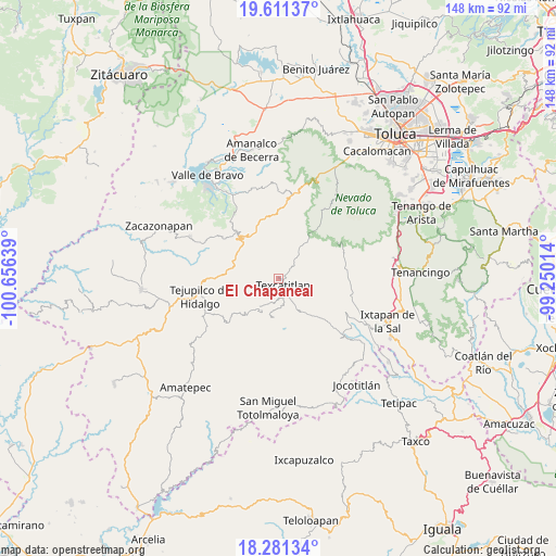
El Chapaneal GPS coordinates[2]
18° 56' 51.648" North, 99° 57' 11.736" West
| Map corner | latitude | longitude |
|---|---|---|
| Upper-left | 19.61137°, | -100.65639° |
| Center: | 18.94768°, | -99.95326° |
| Lower-right: | 18.28134°, | -99.25014° |
| Map W x H: | 147.9×147.9 km | = 91.9×91.9mi |
| max Lat: | 32.7° ⇑65.9% North |
| El Chapaneal: | 18.94768° |
| min Lat: | ⇓34.1% South 14.53588° |
| min Long | El Chapaneal | max Long |
| -117.105° | -99.95326° | -86.73105° |
| W 36.6%⇐ | ⇒63.4% E |
Elevation
Elevation of El Chapaneal is 2404 m = 7887 ft, and this is 1150.3 m = 3774 ft above average elevation for this country.
| Max E: |
3497 m = 11473 ft | 10.1% |
| El Chapaneal | 2404 m 7887 ft | |
| Avg. | 1253.7 m = 4113 ft | |
Min E: |
-1 m = -3 ft | 89.9% |
See also: Mexico elevation on elevation.city.
Geographical zone
El Chapaneal is located in North Torrid zone (between Equator and Tropic of Cancer). Distance of this Northern Tropic circle is 499.1 km =310.1 mi to North.| Distance of | km | miles | from El Chapaneal |
|---|---|---|---|
| North Pole | 7900.3 | 4909 | to North |
| Arctic Circle | 5294.4 | 3289.8 | to North |
| Tropic Cancer | 499.1 | 310.1 | to North |
| Equator | 2106.8 | 1309.1 | to South |


Nearby cities:
15 places around El Chapaneal: (largest is in red/bold)
• Acatitlán
2.8 km =1.7 mi,  173°
173°
• Barrio San José (Barrio Tecolote)
9.7 km =6 mi,  331°
331°
• Capula
8.7 km =5.4 mi,  185°
185°
• Hueyatenco
6.8 km =4.2 mi, 193°
• Palmillas
7.5 km =4.7 mi,  73°
73°
• Pantoja
10.4 km =6.5 mi,  220°
220°
• Rincón de San Andrés
9.5 km =5.9 mi,  353°
353°
• San Agustín
1.6 km =1 mi,  112°
112°
• San Andrés Tepetitlán
6.5 km =4 mi,  147°
147°
• San Andrés de los Gama
10.2 km =6.3 mi, 347°
• San Francisco
5.1 km =3.2 mi, 150°
• San Simón de Guerrero
10 km =6.2 mi, 326°
• Sultepec
10 km =6.2 mi, 187°
• Texcaltitlán
2.5 km =1.6 mi,  141°
141°
• Texcapilla
6.1 km =3.8 mi,  92°
92°
Sources, notices
• [Note1] Compared only with cities in Mexico existing in our database
• [Src1] Map data: © OpenStreetMap contributors (CC-BY-SA)
• [Src2] Other city data from geonames.org with taken over terms of usage.
• [Src3] Geographical zone / Annual Mean Temperature by Robert A. Rohde @ Wikipedia
