San Mateo Huitzilzingo geodata
San Mateo Huitzilzingo (State of Mexico) is a populated place; located in Mexico in America/Mexico_City (GMT-6) time zone. With population of 15,389 people, there are 624 cities with bigger population in this country. Compared to other cities in Mexico, 60.4% of cities are located further ↑North; 51.6% of cities are located further ←West and 84.1% of cities have lower elevation than San Mateo Huitzilzingo. Note1
Current local time in San Mateo Huitzilzingo:
02:49 AM, TuesdayDifference from your time zone: hours


San Mateo Huitzilzingo GPS coordinates[2]
19° 13' 44.616" North, 98° 55' 30.144" West
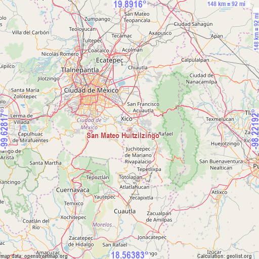
| Map corner | latitude | longitude |
|---|---|---|
| Upper-left | 19.8916°, | -99.62817° |
| Center: | 19.22906°, | -98.92504° |
| Lower-right: | 18.56383°, | -98.22192° |
| Map W x H: | 147.6×147.6 km | = 91.7×91.7mi |
| max Lat: | 32.7° ⇑60.4% North |
| San Mateo Huitzilzingo: | 19.22906° |
| min Lat: | ⇓39.6% South 14.53588° |
| min Long | San Mateo Huitz | max Long |
| -117.105° | -98.92504° | -86.73105° |
| W 51.6%⇐ | ⇒48.4% E |
Elevation
Elevation of San Mateo Huitzilzingo is 2244 m = 7362 ft, and this is 990.3 m = 3249 ft above average elevation for this country.
| Max E: |
3497 m = 11473 ft | 15.9% |
| San Mateo Huitzilzingo | 2244 m 7362 ft | |
| Avg. | 1253.7 m = 4113 ft | |
Min E: |
-1 m = -3 ft | 84.1% |
See also: Mexico elevation on elevation.city.
Geographical zone
San Mateo Huitzilzingo is located in North Torrid zone (between Equator and Tropic of Cancer). Distance of this Northern Tropic circle is 467.8 km =290.7 mi to North.| Distance of | km | miles | from San Mateo Huitzilzingo |
|---|---|---|---|
| North Pole | 7869 | 4889.6 | to North |
| Arctic Circle | 5263.1 | 3270.3 | to North |
| Tropic Cancer | 467.8 | 290.7 | to North |
| Equator | 2138.1 | 1328.6 | to South |


Nearby cities:
15 places around San Mateo Huitzilzingo: (largest is in red/bold)
• Barrio de Guadalupe
0.6 km =0.4 mi,  284°
284°
• Caserío de Cortés
4.6 km =2.9 mi,  222°
222°
• Chalco
4.6 km =2.9 mi,  38°
38°
• Colonia Michoacana
3.1 km =1.9 mi,  151°
151°
• Colonia San José
3.6 km =2.2 mi,  130°
130°
• El Recodo de San José Axalco
3.7 km =2.3 mi,  141°
141°
• Lomas de San Pablo
3 km =1.9 mi,  165°
165°
• Los Reyes Acatlixhuayán
5 km =3.1 mi,  116°
116°
• San Andrés Mixquic
4.1 km =2.5 mi,  263°
263°
• San Ignacio de Loyola
3.6 km =2.2 mi,  246°
246°
• San Juan y San Pedro Tezompa
4.5 km =2.8 mi,  236°
236°
• San Pablo Atlazalpan
2.2 km =1.4 mi, 125°
• Santa Catarina Ayotzingo
2.2 km =1.4 mi,  193°
193°
• Tetelco
5.2 km =3.2 mi, 254°
• Zula
3.9 km =2.4 mi,  104°
104°
Sources, notices
• [Note1] Compared only with cities in Mexico existing in our database
• [Src1] Map data: © OpenStreetMap contributors (CC-BY-SA)
• [Src2] Other city data from geonames.org with taken over terms of usage.
• [Src3] Geographical zone / Annual Mean Temperature by Robert A. Rohde @ Wikipedia
