Lomas de San Pablo geodata
Lomas de San Pablo (State of Mexico) is a populated place; located in Mexico in America/Mexico_City (GMT-6) time zone. With population of 1,354 people, there are 6424 cities with bigger population in this country. Compared to other cities in Mexico, 61.1% of cities are located further ↑North; 51.7% of cities are located further ←West and 86.8% of cities have lower elevation than Lomas de San Pablo. Note1


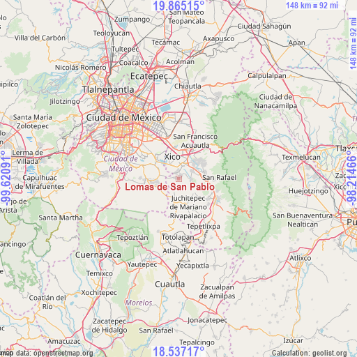
Lomas de San Pablo GPS coordinates[2]
19° 12' 9" North, 98° 55' 4.008" West
| Map corner | latitude | longitude |
|---|---|---|
| Upper-left | 19.86515°, | -99.62091° |
| Center: | 19.2025°, | -98.91778° |
| Lower-right: | 18.53717°, | -98.21466° |
| Map W x H: | 147.7×147.7 km | = 91.8×91.8mi |
| max Lat: | 32.7° ⇑61.1% North |
| Lomas de San Pablo: | 19.2025° |
| min Lat: | ⇓38.9% South 14.53588° |
| min Long | Lomas de San Pa | max Long |
| -117.105° | -98.91778° | -86.73105° |
| W 51.7%⇐ | ⇒48.3% E |
Elevation
Elevation of Lomas de San Pablo is 2304 m = 7559 ft, and this is 1050.3 m = 3446 ft above average elevation for this country.
| Max E: |
3497 m = 11473 ft | 13.2% |
| Lomas de San Pablo | 2304 m 7559 ft | |
| Avg. | 1253.7 m = 4113 ft | |
Min E: |
-1 m = -3 ft | 86.8% |
See also: Mexico elevation on elevation.city.
Geographical zone
Lomas de San Pablo is located in North Torrid zone (between Equator and Tropic of Cancer). Distance of this Northern Tropic circle is 470.8 km =292.5 mi to North.| Distance of | km | miles | from Lomas de San Pablo |
|---|---|---|---|
| North Pole | 7871.9 | 4891.4 | to North |
| Arctic Circle | 5266.1 | 3272.2 | to North |
| Tropic Cancer | 470.8 | 292.5 | to North |
| Equator | 2135.1 | 1326.7 | to South |


Nearby cities:
15 places around Lomas de San Pablo: (largest is in red/bold)
• Barrio de Guadalupe
3.4 km =2.1 mi,  336°
336°
• Caserío de Cortés
3.9 km =2.4 mi,  263°
263°
• Colonia Michoacana
0.7 km =0.4 mi,  70°
70°
• Colonia San José
2.1 km =1.3 mi, 72°
• El Recodo de San José Axalco
1.6 km =1 mi,  88°
88°
• Los Reyes Acatlixhuayán
3.8 km =2.4 mi,  79°
79°
• San Andrés Mixquic
5.5 km =3.4 mi,  297°
297°
• San Ignacio de Loyola
4.4 km =2.7 mi,  290°
290°
• San Juan y San Pedro Tezompa
4.5 km =2.8 mi,  276°
276°
• San Mateo Huitzilzingo
3 km =1.9 mi,  345°
345°
• San Pablo Atlazalpan
2 km =1.2 mi,  32°
32°
• Santa Catarina Ayotzingo
1.5 km =0.9 mi, 301°
• Temamatla
5.1 km =3.2 mi, 89°
• Tetelco
6 km =3.7 mi, 285°
• Zula
3.6 km =2.2 mi,  56°
56°
Sources, notices
• [Note1] Compared only with cities in Mexico existing in our database
• [Src1] Map data: © OpenStreetMap contributors (CC-BY-SA)
• [Src2] Other city data from geonames.org with taken over terms of usage.
• [Src3] Geographical zone / Annual Mean Temperature by Robert A. Rohde @ Wikipedia
