Los Reyes Acatlixhuayán geodata
Los Reyes Acatlixhuayán (State of Mexico) is a populated place; located in Mexico in America/Mexico_City (GMT-6) time zone. With population of 1,105 people, there are 7868 cities with bigger population in this country. Compared to other cities in Mexico, 61% of cities are located further ↑North; 52.2% of cities are located further ←West and 85.4% of cities have lower elevation than Los Reyes Acatlixhuayán. Note1
Current local time in Los Reyes Acatlixhuayán:
08:30 AM, WednesdayDifference from your time zone: hours


Los Reyes Acatlixhuayán GPS coordinates[2]
19° 12' 32.004" North, 98° 52' 56.712" West
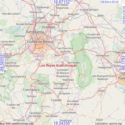
| Map corner | latitude | longitude |
|---|---|---|
| Upper-left | 19.87152°, | -99.58555° |
| Center: | 19.20889°, | -98.88242° |
| Lower-right: | 18.54358°, | -98.1793° |
| Map W x H: | 147.7×147.7 km | = 91.8×91.8mi |
| max Lat: | 32.7° ⇑61% North |
| Los Reyes Acatlixhuayán: | 19.20889° |
| min Lat: | ⇓39% South 14.53588° |
| min Long | Los Reyes Acatl | max Long |
| -117.105° | -98.88242° | -86.73105° |
| W 52.2%⇐ | ⇒47.8% E |
Elevation
Elevation of Los Reyes Acatlixhuayán is 2267 m = 7438 ft, and this is 1013.3 m = 3324 ft above average elevation for this country.
| Max E: |
3497 m = 11473 ft | 14.6% |
| Los Reyes Acatlixhuayán | 2267 m 7438 ft | |
| Avg. | 1253.7 m = 4113 ft | |
Min E: |
-1 m = -3 ft | 85.4% |
See also: Mexico elevation on elevation.city.
Geographical zone
Los Reyes Acatlixhuayán is located in North Torrid zone (between Equator and Tropic of Cancer). Distance of this Northern Tropic circle is 470.1 km =292.1 mi to North.| Distance of | km | miles | from Los Reyes Acatlixhuayán |
|---|---|---|---|
| North Pole | 7871.2 | 4890.9 | to North |
| Arctic Circle | 5265.3 | 3271.7 | to North |
| Tropic Cancer | 470.1 | 292.1 | to North |
| Equator | 2135.8 | 1327.1 | to South |


Nearby cities:
15 places around Los Reyes Acatlixhuayán: (largest is in red/bold)
• Barrio de Guadalupe
5.6 km =3.5 mi,  295°
295°
• Cocotitlán
3.2 km =2 mi,  32°
32°
• Colonia Michoacana
3 km =1.9 mi,  261°
261°
• Colonia San José
1.7 km =1.1 mi,  266°
266°
• Ejido Atoyac
4 km =2.5 mi,  60°
60°
• El Cabi
3.7 km =2.3 mi,  125°
125°
• El Recodo de San José Axalco
2.2 km =1.4 mi,  252°
252°
• La Candelaria Tlapala
5.1 km =3.2 mi,  46°
46°
• Lomas de San Pablo
3.8 km =2.4 mi, 259°
• San Andrés Metla
4.4 km =2.7 mi,  78°
78°
• San Mateo Huitzilzingo
5 km =3.1 mi, 296°
• San Pablo Atlazalpan
2.8 km =1.7 mi,  289°
289°
• Santa Catarina Ayotzingo
5 km =3.1 mi, 270°
• Temamatla
1.5 km =0.9 mi,  115°
115°
• Zula
1.5 km =0.9 mi,  329°
329°
Sources, notices
• [Note1] Compared only with cities in Mexico existing in our database
• [Src1] Map data: © OpenStreetMap contributors (CC-BY-SA)
• [Src2] Other city data from geonames.org with taken over terms of usage.
• [Src3] Geographical zone / Annual Mean Temperature by Robert A. Rohde @ Wikipedia
