San Lucas Amalinalco geodata
San Lucas Amalinalco (State of Mexico) is a populated place; located in Mexico in America/Mexico_City (GMT-6) time zone. With population of 3,626 people, there are 2528 cities with bigger population in this country. Compared to other cities in Mexico, 59.4% of cities are located further ↑North; 52.5% of cities are located further ←West and 84.4% of cities have lower elevation than San Lucas Amalinalco. Note1
Current local time in San Lucas Amalinalco:
08:27 AM, WednesdayDifference from your time zone: hours


San Lucas Amalinalco GPS coordinates[2]
19° 16' 13.656" North, 98° 51' 50.508" West
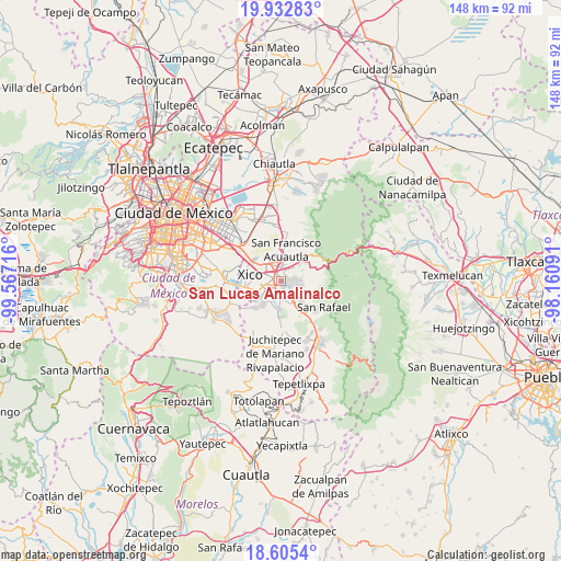
| Map corner | latitude | longitude |
|---|---|---|
| Upper-left | 19.93283°, | -99.56716° |
| Center: | 19.27046°, | -98.86403° |
| Lower-right: | 18.6054°, | -98.16091° |
| Map W x H: | 147.6×147.6 km | = 91.7×91.7mi |
| max Lat: | 32.7° ⇑59.4% North |
| San Lucas Amalinalco: | 19.27046° |
| min Lat: | ⇓40.6% South 14.53588° |
| min Long | San Lucas Amali | max Long |
| -117.105° | -98.86403° | -86.73105° |
| W 52.5%⇐ | ⇒47.5% E |
Elevation
Elevation of San Lucas Amalinalco is 2250 m = 7382 ft, and this is 996.3 m = 3269 ft above average elevation for this country.
| Max E: |
3497 m = 11473 ft | 15.6% |
| San Lucas Amalinalco | 2250 m 7382 ft | |
| Avg. | 1253.7 m = 4113 ft | |
Min E: |
-1 m = -3 ft | 84.4% |
See also: Mexico elevation on elevation.city.
Geographical zone
San Lucas Amalinalco is located in North Torrid zone (between Equator and Tropic of Cancer). Distance of this Northern Tropic circle is 463.2 km =287.8 mi to North.| Distance of | km | miles | from San Lucas Amalinalco |
|---|---|---|---|
| North Pole | 7864.4 | 4886.7 | to North |
| Arctic Circle | 5258.5 | 3267.5 | to North |
| Tropic Cancer | 463.2 | 287.8 | to North |
| Equator | 2142.7 | 1331.4 | to South |


Nearby cities:
15 places around San Lucas Amalinalco: (largest is in red/bold)
• Chalco
3.7 km =2.3 mi,  254°
254°
• Cocotitlán
4.1 km =2.5 mi,  182°
182°
• Ejido Atoyac
5.1 km =3.2 mi,  161°
161°
• Ex-Hacienda de Guadalupe
3.3 km =2.1 mi,  143°
143°
• Ixtapaluca
5.4 km =3.4 mi,  338°
338°
• Jorge Jiménez Cantú
4.7 km =2.9 mi,  22°
22°
• La Candelaria Tlapala
3.8 km =2.4 mi,  152°
152°
• San Buenaventura
3.6 km =2.2 mi,  1°
1°
• San Gregorio Cuautzingo
1.4 km =0.9 mi, 150°
• San Jerónimo Cuatro Vientos
3.4 km =2.1 mi,  43°
43°
• San Marcos Huixtoco
2.9 km =1.8 mi, 0°
• San Martín Cuautlalpan
3.5 km =2.2 mi,  79°
79°
• Santa María Huexoculco
4.8 km =3 mi,  106°
106°
• Zoquiapan
5.5 km =3.4 mi, 16°
• Zula
6.2 km =3.9 mi,  205°
205°
Sources, notices
• [Note1] Compared only with cities in Mexico existing in our database
• [Src1] Map data: © OpenStreetMap contributors (CC-BY-SA)
• [Src2] Other city data from geonames.org with taken over terms of usage.
• [Src3] Geographical zone / Annual Mean Temperature by Robert A. Rohde @ Wikipedia
