Santa María Huexoculco geodata
Santa María Huexoculco (State of Mexico) is a populated place; located in Mexico in America/Mexico_City (GMT-6) time zone. With population of 12,456 people, there are 780 cities with bigger population in this country. Compared to other cities in Mexico, 59.7% of cities are located further ↑North; 53.3% of cities are located further ←West and 86.4% of cities have lower elevation than Santa María Huexoculco. Note1
Current local time in Santa María Huexoculco:
01:28 AM, TuesdayDifference from your time zone: hours


Santa María Huexoculco GPS coordinates[2]
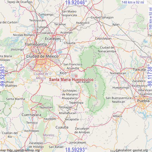
19° 15' 28.944" North, 98° 49' 13.8" West
| Map corner | latitude | longitude |
|---|---|---|
| Upper-left | 19.92046°, | -99.52363° |
| Center: | 19.25804°, | -98.8205° |
| Lower-right: | 18.59293°, | -98.11738° |
| Map W x H: | 147.6×147.6 km | = 91.7×91.7mi |
| max Lat: | 32.7° ⇑59.7% North |
| Santa María Huexoculco: | 19.25804° |
| min Lat: | ⇓40.3% South 14.53588° |
| min Long | Santa María Hu | max Long |
| -117.105° | -98.8205° | -86.73105° |
| W 53.3%⇐ | ⇒46.7% E |
Elevation
Elevation of Santa María Huexoculco is 2293 m = 7523 ft, and this is 1039.3 m = 3410 ft above average elevation for this country.
| Max E: |
3497 m = 11473 ft | 13.6% |
| Santa María Huexoculco | 2293 m 7523 ft | |
| Avg. | 1253.7 m = 4113 ft | |
Min E: |
-1 m = -3 ft | 86.4% |
See also: Mexico elevation on elevation.city.
Geographical zone
Santa María Huexoculco is located in North Torrid zone (between Equator and Tropic of Cancer). Distance of this Northern Tropic circle is 464.6 km =288.7 mi to North.| Distance of | km | miles | from Santa María Huexoculco |
|---|---|---|---|
| North Pole | 7865.8 | 4887.6 | to North |
| Arctic Circle | 5259.9 | 3268.3 | to North |
| Tropic Cancer | 464.6 | 288.7 | to North |
| Equator | 2141.3 | 1330.5 | to South |


Nearby cities:
15 places around Santa María Huexoculco: (largest is in red/bold)
• Cocotitlán
5.5 km =3.4 mi,  240°
240°
• Ejido Atoyac
4.6 km =2.9 mi,  220°
220°
• Ex-Hacienda de Guadalupe
2.9 km =1.8 mi, 243°
• Jorge Jiménez Cantú
6.4 km =4 mi,  334°
334°
• La Candelaria Tlapala
3.5 km =2.2 mi, 235°
• Miraflores
4.2 km =2.6 mi,  161°
161°
• San Andrés Metla
5.1 km =3.2 mi,  205°
205°
• San Buenaventura
6.7 km =4.2 mi,  317°
317°
• San Gregorio Cuautzingo
3.9 km =2.4 mi,  272°
272°
• San Jerónimo Cuatro Vientos
4.5 km =2.8 mi, 330°
• San Lorenzo Tlalmimilolpan
4.4 km =2.7 mi, 158°
• San Lucas Amalinalco
4.8 km =3 mi,  286°
286°
• San Marcos Huixtoco
6.2 km =3.9 mi,  313°
313°
• San Martín Cuautlalpan
2.3 km =1.4 mi, 329°
• Tlalmanalco
6.2 km =3.9 mi, 160°
Sources, notices
• [Note1] Compared only with cities in Mexico existing in our database
• [Src1] Map data: © OpenStreetMap contributors (CC-BY-SA)
• [Src2] Other city data from geonames.org with taken over terms of usage.
• [Src3] Geographical zone / Annual Mean Temperature by Robert A. Rohde @ Wikipedia
