Zoquiapan geodata
Zoquiapan (State of Mexico) is a populated place; located in Mexico in America/Mexico_City (GMT-6) time zone. With population of 1,720 people, there are 5045 cities with bigger population in this country. Compared to other cities in Mexico, 58.4% of cities are located further ↑North; 52.8% of cities are located further ←West and 85.7% of cities have lower elevation than Zoquiapan. Note1


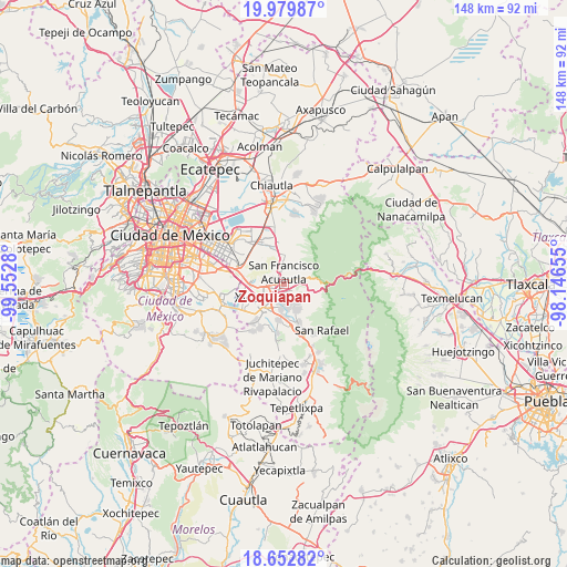
Zoquiapan GPS coordinates[2]
19° 19' 3.684" North, 98° 50' 58.812" West
| Map corner | latitude | longitude |
|---|---|---|
| Upper-left | 19.97987°, | -99.5528° |
| Center: | 19.31769°, | -98.84967° |
| Lower-right: | 18.65282°, | -98.14655° |
| Map W x H: | 147.6×147.6 km | = 91.7×91.7mi |
| max Lat: | 32.7° ⇑58.4% North |
| Zoquiapan: | 19.31769° |
| min Lat: | ⇓41.6% South 14.53588° |
| min Long | Zoquiapan | max Long |
| -117.105° | -98.84967° | -86.73105° |
| W 52.8%⇐ | ⇒47.2% E |
Elevation
Elevation of Zoquiapan is 2275 m = 7464 ft, and this is 1021.3 m = 3351 ft above average elevation for this country.
| Max E: |
3497 m = 11473 ft | 14.3% |
| Zoquiapan | 2275 m 7464 ft | |
| Avg. | 1253.7 m = 4113 ft | |
Min E: |
-1 m = -3 ft | 85.7% |
See also: Mexico elevation on elevation.city.
Geographical zone
Zoquiapan is located in North Torrid zone (between Equator and Tropic of Cancer). Distance of this Northern Tropic circle is 458 km =284.6 mi to North.| Distance of | km | miles | from Zoquiapan |
|---|---|---|---|
| North Pole | 7859.1 | 4883.4 | to North |
| Arctic Circle | 5253.2 | 3264.2 | to North |
| Tropic Cancer | 458 | 284.6 | to North |
| Equator | 2147.9 | 1334.6 | to South |


Nearby cities:
15 places around Zoquiapan: (largest is in red/bold)
• Ampliación 6 de Junio
8.3 km =5.2 mi,  284°
284°
• Chalco
8 km =5 mi,  219°
219°
• Coatepec
7.5 km =4.7 mi,  3°
3°
• Ex-Hacienda de Guadalupe
7.9 km =4.9 mi,  176°
176°
• Ixtapaluca
3.5 km =2.2 mi,  266°
266°
• Jorge Jiménez Cantú
0.9 km =0.6 mi,  160°
160°
• Los Hornos
4.5 km =2.8 mi,  347°
347°
• San Buenaventura
2.2 km =1.4 mi, 219°
• San Francisco Acuautla
3.3 km =2.1 mi,  340°
340°
• San Gregorio Cuautzingo
6.5 km =4 mi,  187°
187°
• San Jerónimo Cuatro Vientos
2.9 km =1.8 mi, 162°
• San Lucas Amalinalco
5.5 km =3.4 mi,  196°
196°
• San Marcos Huixtoco
2.8 km =1.7 mi,  212°
212°
• San Martín Cuautlalpan
5 km =3.1 mi, 157°
• Santa María Huexoculco
7.3 km =4.5 mi, 155°
Sources, notices
• [Note1] Compared only with cities in Mexico existing in our database
• [Src1] Map data: © OpenStreetMap contributors (CC-BY-SA)
• [Src2] Other city data from geonames.org with taken over terms of usage.
• [Src3] Geographical zone / Annual Mean Temperature by Robert A. Rohde @ Wikipedia
