Ex-Hacienda de Guadalupe geodata
Ex-Hacienda de Guadalupe (State of Mexico) is a populated place; located in Mexico in America/Mexico_City (GMT-6) time zone. With population of 968 people, there are 8990 cities with bigger population in this country. Compared to other cities in Mexico, 60% of cities are located further ↑North; 52.9% of cities are located further ←West and 85.2% of cities have lower elevation than Ex-Hacienda de Guadalupe. Note1
Current local time in Ex-Hacienda de Guadalupe:
12:30 PM, MondayDifference from your time zone: hours


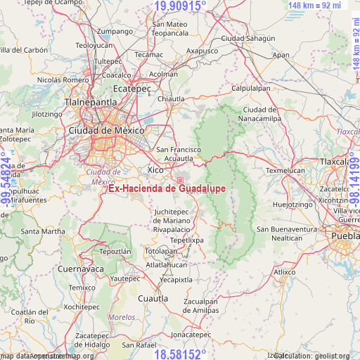
Ex-Hacienda de Guadalupe GPS coordinates[2]
19° 14' 48.048" North, 98° 50' 42.396" West
| Map corner | latitude | longitude |
|---|---|---|
| Upper-left | 19.90915°, | -99.54824° |
| Center: | 19.24668°, | -98.84511° |
| Lower-right: | 18.58152°, | -98.14199° |
| Map W x H: | 147.6×147.6 km | = 91.7×91.7mi |
| max Lat: | 32.7° ⇑60% North |
| Ex-Hacienda de Guadalupe: | 19.24668° |
| min Lat: | ⇓40% South 14.53588° |
| min Long | Ex-Hacienda de | max Long |
| -117.105° | -98.84511° | -86.73105° |
| W 52.9%⇐ | ⇒47.1% E |
Elevation
Elevation of Ex-Hacienda de Guadalupe is 2263 m = 7425 ft, and this is 1009.3 m = 3311 ft above average elevation for this country.
| Max E: |
3497 m = 11473 ft | 14.8% |
| Ex-Hacienda de Guadalupe | 2263 m 7425 ft | |
| Avg. | 1253.7 m = 4113 ft | |
Min E: |
-1 m = -3 ft | 85.2% |
See also: Mexico elevation on elevation.city.
Geographical zone
Ex-Hacienda de Guadalupe is located in North Torrid zone (between Equator and Tropic of Cancer). Distance of this Northern Tropic circle is 465.9 km =289.5 mi to North.| Distance of | km | miles | from Ex-Hacienda de Guadalupe |
|---|---|---|---|
| North Pole | 7867 | 4888.3 | to North |
| Arctic Circle | 5261.1 | 3269.1 | to North |
| Tropic Cancer | 465.9 | 289.5 | to North |
| Equator | 2140 | 1329.7 | to South |


Nearby cities:
15 places around Ex-Hacienda de Guadalupe: (largest is in red/bold)
• Chalco
5.8 km =3.6 mi,  286°
286°
• Cocotitlán
2.6 km =1.6 mi,  235°
235°
• Ejido Atoyac
2.3 km =1.4 mi,  190°
190°
• La Candelaria Tlapala
0.7 km =0.4 mi,  201°
201°
• Los Reyes Acatlixhuayán
5.7 km =3.5 mi,  222°
222°
• Miraflores
4.8 km =3 mi,  124°
124°
• San Andrés Metla
3.3 km =2.1 mi,  173°
173°
• San Gregorio Cuautzingo
1.9 km =1.2 mi,  318°
318°
• San Jerónimo Cuatro Vientos
5.2 km =3.2 mi,  4°
4°
• San Lorenzo Tlalmimilolpan
5.1 km =3.2 mi, 123°
• San Lucas Amalinalco
3.3 km =2.1 mi, 323°
• San Martín Cuautlalpan
3.6 km =2.2 mi,  23°
23°
• Santa María Huexoculco
2.9 km =1.8 mi,  63°
63°
• Temamatla
5.5 km =3.4 mi,  207°
207°
• Zula
5.5 km =3.4 mi, 237°
Sources, notices
• [Note1] Compared only with cities in Mexico existing in our database
• [Src1] Map data: © OpenStreetMap contributors (CC-BY-SA)
• [Src2] Other city data from geonames.org with taken over terms of usage.
• [Src3] Geographical zone / Annual Mean Temperature by Robert A. Rohde @ Wikipedia
