Venustiano Carranza geodata
Venustiano Carranza (Puebla) is a populated place; located in Mexico in America/Mexico_City (GMT-6) time zone. With population of 6,263 people, there are 1484 cities with bigger population in this country. Compared to other cities in Mexico, 67.9% of cities are located further ↓South; 67.7% of cities are located further ←West and 77.9% of cities have higher elevation than Venustiano Carranza. Note1


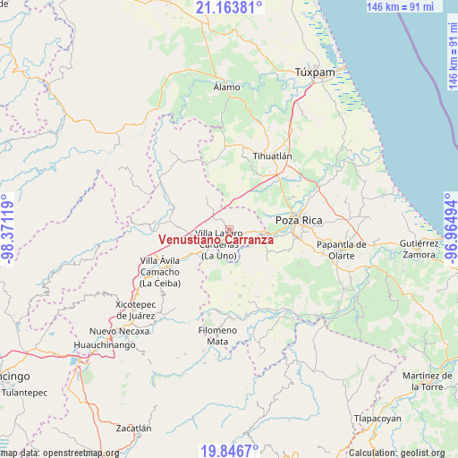
Venustiano Carranza GPS coordinates[2]
20° 30' 24.012" North, 97° 40' 5.016" West
| Map corner | latitude | longitude |
|---|---|---|
| Upper-left | 21.16381°, | -98.37119° |
| Center: | 20.50667°, | -97.66806° |
| Lower-right: | 19.8467°, | -96.96494° |
| Map W x H: | 146.4×146.5 km | = 91×91mi |
| max Lat: | 32.7° ⇑32.1% North |
| Venustiano Carranza: | 20.50667° |
| min Lat: | ⇓67.9% South 14.53588° |
| min Long | Venustiano Carr | max Long |
| -117.105° | -97.66806° | -86.73105° |
| W 67.7%⇐ | ⇒32.3% E |
Elevation
Elevation of Venustiano Carranza is 132 m = 433 ft, and this is 1121.7 m = 3680 ft below average elevation for this country.
| Max E: |
3497 m = 11473 ft | 77.9% |
| Avg. | 1253.7 m = 4113 ft | |
| Venustiano Carranza | 132 m = 433 ft | |
Min E: |
-1 m = -3 ft | 22.1% |
See also: Mexico elevation on elevation.city.
Geographical zone
Venustiano Carranza is located in North Torrid zone (between Equator and Tropic of Cancer). Distance of this Northern Tropic circle is 325.8 km =202.4 mi to North.| Distance of | km | miles | from Venustiano Carranza |
|---|---|---|---|
| North Pole | 7726.9 | 4801.3 | to North |
| Arctic Circle | 5121 | 3182 | to North |
| Tropic Cancer | 325.8 | 202.4 | to North |
| Equator | 2280.1 | 1416.8 | to South |


Nearby cities:
15 places around Venustiano Carranza: (largest is in red/bold)
• Antonio M. Quirazco
9.4 km =5.8 mi,  48°
48°
• Chicualoque
13.8 km =8.6 mi,  177°
177°
• Coronel Tito Hernández
9 km =5.6 mi,  231°
231°
• Estrella Roja
7.6 km =4.7 mi,  189°
189°
• Huitzilac
13.5 km =8.4 mi,  325°
325°
• La Libertad
6.6 km =4.1 mi,  201°
201°
• Nuevo Zoquiapan
12.4 km =7.7 mi, 231°
• Paso de Coyutla
8.5 km =5.3 mi, 203°
• Piedras Negras
12.2 km =7.6 mi, 233°
• Poza Azul de los Reyes
12.7 km =7.9 mi,  351°
351°
• San Bartolo del Escobal
8.4 km =5.2 mi, 176°
• San José
7.2 km =4.5 mi, 331°
• Santa María
11.7 km =7.3 mi,  106°
106°
• Villa Lázaro Cárdenas
6 km =3.7 mi,  213°
213°
• Vizcaíno
10.7 km =6.6 mi,  103°
103°
Sources, notices
• [Note1] Compared only with cities in Mexico existing in our database
• [Src1] Map data: © OpenStreetMap contributors (CC-BY-SA)
• [Src2] Other city data from geonames.org with taken over terms of usage.
• [Src3] Geographical zone / Annual Mean Temperature by Robert A. Rohde @ Wikipedia
