Huitzilac geodata
Huitzilac (Puebla) is a populated place; located in Mexico in America/Mexico_City (GMT-6) time zone. With population of 1,188 people, there are 7313 cities with bigger population in this country. Compared to other cities in Mexico, 70.1% of cities are located further ↓South; 66.7% of cities are located further ←West and 76.9% of cities have higher elevation than Huitzilac. Note1


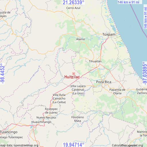
Huitzilac GPS coordinates[2]
20° 36' 24.084" North, 97° 44' 31.452" West
| Map corner | latitude | longitude |
|---|---|---|
| Upper-left | 21.26339°, | -98.4452° |
| Center: | 20.60669°, | -97.74207° |
| Lower-right: | 19.94714°, | -97.03895° |
| Map W x H: | 146.4×146.4 km | = 91×91mi |
| max Lat: | 32.7° ⇑29.9% North |
| Huitzilac: | 20.60669° |
| min Lat: | ⇓70.1% South 14.53588° |
| min Long | Huitzilac | max Long |
| -117.105° | -97.74207° | -86.73105° |
| W 66.7%⇐ | ⇒33.3% E |
Elevation
Elevation of Huitzilac is 156 m = 512 ft, and this is 1097.7 m = 3601 ft below average elevation for this country.
| Max E: |
3497 m = 11473 ft | 76.9% |
| Avg. | 1253.7 m = 4113 ft | |
| Huitzilac | 156 m = 512 ft | |
Min E: |
-1 m = -3 ft | 23.1% |
See also: Mexico elevation on elevation.city.
Geographical zone
Huitzilac is located in North Torrid zone (between Equator and Tropic of Cancer). Distance of this Northern Tropic circle is 314.7 km =195.5 mi to North.| Distance of | km | miles | from Huitzilac |
|---|---|---|---|
| North Pole | 7715.8 | 4794.4 | to North |
| Arctic Circle | 5109.9 | 3175.1 | to North |
| Tropic Cancer | 314.7 | 195.5 | to North |
| Equator | 2291.2 | 1423.7 | to South |


Nearby cities:
15 places around Huitzilac: (largest is in red/bold)
• Agua Linda
13.1 km =8.1 mi,  259°
259°
• Ameluca
9.9 km =6.2 mi,  241°
241°
• Antonio M. Quirazco
15.5 km =9.6 mi,  108°
108°
• Jaltocan
8 km =5 mi,  280°
280°
• La Defensa
7.3 km =4.5 mi,  19°
19°
• La Guadalupe
14.8 km =9.2 mi,  46°
46°
• La Pahua
11.6 km =7.2 mi,  272°
272°
• Las Balsas
11.6 km =7.2 mi,  337°
337°
• Mecapalapa
14.9 km =9.3 mi,  233°
233°
• Moctezuma
13.1 km =8.1 mi,  325°
325°
• Poza Azul de los Reyes
6 km =3.7 mi,  75°
75°
• Progreso de Allende
16.1 km =10 mi, 275°
• San José
6.4 km =4 mi,  138°
138°
• Teayo
16.6 km =10.3 mi, 23°
• Venustiano Carranza
13.5 km =8.4 mi,  145°
145°
Sources, notices
• [Note1] Compared only with cities in Mexico existing in our database
• [Src1] Map data: © OpenStreetMap contributors (CC-BY-SA)
• [Src2] Other city data from geonames.org with taken over terms of usage.
• [Src3] Geographical zone / Annual Mean Temperature by Robert A. Rohde @ Wikipedia
