Álvaro Obregón geodata
Álvaro Obregón (Puebla) is a populated place; located in Mexico in America/Mexico_City (GMT-6) time zone. With population of 1,641 people, there are 5282 cities with bigger population in this country. Compared to other cities in Mexico, 64.2% of cities are located further ↑North; 64.8% of cities are located further ←West and 86.3% of cities have lower elevation than Álvaro Obregón. Note1


Álvaro Obregón GPS coordinates[2]
19° 1' 40.116" North, 97° 54' 7.884" West
| Map corner | latitude | longitude |
|---|---|---|
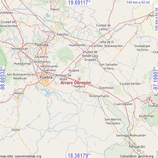
| Upper-left | 19.69117°, | -98.60532° |
| Center: | 19.02781°, | -97.90219° |
| Lower-right: | 18.36179°, | -97.19907° |
| Map W x H: | 147.8×147.8 km | = 91.8×91.8mi |
| max Lat: | 32.7° ⇑64.2% North |
| Álvaro Obregón: | 19.02781° |
| min Lat: | ⇓35.8% South 14.53588° |
| min Long | Álvaro Obregó | max Long |
| -117.105° | -97.90219° | -86.73105° |
| W 64.8%⇐ | ⇒35.2% E |
Elevation
Elevation of Álvaro Obregón is 2289 m = 7510 ft, and this is 1035.3 m = 3397 ft above average elevation for this country.
| Max E: |
3497 m = 11473 ft | 13.7% |
| Álvaro Obregón | 2289 m 7510 ft | |
| Avg. | 1253.7 m = 4113 ft | |
Min E: |
-1 m = -3 ft | 86.3% |
See also: Mexico elevation on elevation.city.
Geographical zone
Álvaro Obregón is located in North Torrid zone (between Equator and Tropic of Cancer). Distance of this Northern Tropic circle is 490.2 km =304.6 mi to North.| Distance of | km | miles | from Álvaro Obregón |
|---|---|---|---|
| North Pole | 7891.4 | 4903.5 | to North |
| Arctic Circle | 5285.5 | 3284.3 | to North |
| Tropic Cancer | 490.2 | 304.6 | to North |
| Equator | 2115.7 | 1314.6 | to South |


Nearby cities:
15 places around Álvaro Obregón: (largest is in red/bold)
• Apango de Zaragoza
6 km =3.7 mi,  318°
318°
• Benito Juárez
5.2 km =3.2 mi,  113°
113°
• La Magdalena Tetela Morelos
4.8 km =3 mi,  300°
300°
• San Antonio Tlacamilco
4.9 km =3 mi, 322°
• San Bartolomé Hueyapan
3 km =1.9 mi,  264°
264°
• San Felipe Tenextepec
2.9 km =1.8 mi,  82°
82°
• San Jerónimo Ocotitla
6.5 km =4 mi,  273°
273°
• San José Carpinteros
3.8 km =2.4 mi,  195°
195°
• San Lorenzo Joya de Rodríguez
5.9 km =3.7 mi,  60°
60°
• San Mateo Parra
5.9 km =3.7 mi,  133°
133°
• San Miguel
6.7 km =4.2 mi,  47°
47°
• Santiago Acatlán
5.1 km =3.2 mi,  220°
220°
• Tepeaca
6.8 km =4.2 mi,  177°
177°
• Tlacamilco
5.6 km =3.5 mi,  344°
344°
• Zahuatlán de Morelos (San José)
6.1 km =3.8 mi,  143°
143°
Sources, notices
• [Note1] Compared only with cities in Mexico existing in our database
• [Src1] Map data: © OpenStreetMap contributors (CC-BY-SA)
• [Src2] Other city data from geonames.org with taken over terms of usage.
• [Src3] Geographical zone / Annual Mean Temperature by Robert A. Rohde @ Wikipedia
