San Miguel geodata
San Miguel (Puebla) is a populated place; located in Mexico in America/Mexico_City (GMT-6) time zone. With population of 640 people, there are 13529 cities with bigger population in this country. Compared to other cities in Mexico, 63.6% of cities are located further ↑North; 65.4% of cities are located further ←West and 92.1% of cities have lower elevation than San Miguel. Note1


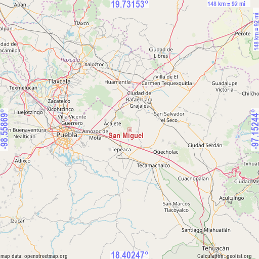
San Miguel GPS coordinates[2]
19° 4' 5.988" North, 97° 51' 20.016" West
| Map corner | latitude | longitude |
|---|---|---|
| Upper-left | 19.73153°, | -98.55869° |
| Center: | 19.06833°, | -97.85556° |
| Lower-right: | 18.40247°, | -97.15244° |
| Map W x H: | 147.8×147.8 km | = 91.8×91.8mi |
| max Lat: | 32.7° ⇑63.6% North |
| San Miguel: | 19.06833° |
| min Lat: | ⇓36.4% South 14.53588° |
| min Long | San Miguel | max Long |
| -117.105° | -97.85556° | -86.73105° |
| W 65.4%⇐ | ⇒34.6% E |
Elevation
Elevation of San Miguel is 2490 m = 8169 ft, and this is 1236.3 m = 4056 ft above average elevation for this country.
| Max E: |
3497 m = 11473 ft | 7.9% |
| San Miguel | 2490 m 8169 ft | |
| Avg. | 1253.7 m = 4113 ft | |
Min E: |
-1 m = -3 ft | 92.1% |
See also: Mexico elevation on elevation.city.
Geographical zone
San Miguel is located in North Torrid zone (between Equator and Tropic of Cancer). Distance of this Northern Tropic circle is 485.7 km =301.8 mi to North.| Distance of | km | miles | from San Miguel |
|---|---|---|---|
| North Pole | 7886.9 | 4900.7 | to North |
| Arctic Circle | 5281 | 3281.5 | to North |
| Tropic Cancer | 485.7 | 301.8 | to North |
| Equator | 2120.2 | 1317.4 | to South |


Nearby cities:
15 places around San Miguel: (largest is in red/bold)
• Benito Juárez
6.6 km =4.1 mi,  181°
181°
• Carmen Serdán
5.8 km =3.6 mi,  127°
127°
• Guadalupe Morelos
7.2 km =4.5 mi, 131°
• Hernández
6.5 km =4 mi,  64°
64°
• Los Reyes de Ocampo
2.6 km =1.6 mi,  137°
137°
• Nicolás Bravo
6.7 km =4.2 mi,  149°
149°
• San Cristóbal Hidalgo
7 km =4.3 mi, 137°
• San Felipe Tenextepec
4.6 km =2.9 mi,  206°
206°
• San Francisco Buenavista
5.1 km =3.2 mi,  155°
155°
• San Lorenzo Joya de Rodríguez
1.6 km =1 mi,  171°
171°
• San Pedro la Joya
1.9 km =1.2 mi,  100°
100°
• Santa Cuz del Bosque
7.7 km =4.8 mi,  18°
18°
• Tlacamilco
6.4 km =4 mi,  277°
277°
• Vincente Guerrero
4.2 km =2.6 mi, 104°
• Álvaro Obregón
6.7 km =4.2 mi,  227°
227°
Sources, notices
• [Note1] Compared only with cities in Mexico existing in our database
• [Src1] Map data: © OpenStreetMap contributors (CC-BY-SA)
• [Src2] Other city data from geonames.org with taken over terms of usage.
• [Src3] Geographical zone / Annual Mean Temperature by Robert A. Rohde @ Wikipedia
