San Antonio Tlacamilco geodata
San Antonio Tlacamilco (Puebla) is a populated place; located in Mexico in America/Mexico_City (GMT-6) time zone. With population of 1,820 people, there are 4784 cities with bigger population in this country. Compared to other cities in Mexico, 63.7% of cities are located further ↑North; 64.5% of cities are located further ←West and 88.1% of cities have lower elevation than San Antonio Tlacamilco. Note1


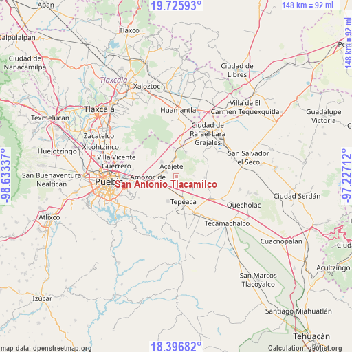
San Antonio Tlacamilco GPS coordinates[2]
19° 3' 45.756" North, 97° 55' 48.864" West
| Map corner | latitude | longitude |
|---|---|---|
| Upper-left | 19.72593°, | -98.63337° |
| Center: | 19.06271°, | -97.93024° |
| Lower-right: | 18.39682°, | -97.22712° |
| Map W x H: | 147.8×147.8 km | = 91.8×91.8mi |
| max Lat: | 32.7° ⇑63.7% North |
| San Antonio Tlacamilco: | 19.06271° |
| min Lat: | ⇓36.3% South 14.53588° |
| min Long | San Antonio Tla | max Long |
| -117.105° | -97.93024° | -86.73105° |
| W 64.5%⇐ | ⇒35.5% E |
Elevation
Elevation of San Antonio Tlacamilco is 2344 m = 7690 ft, and this is 1090.3 m = 3577 ft above average elevation for this country.
| Max E: |
3497 m = 11473 ft | 11.9% |
| San Antonio Tlacamilco | 2344 m 7690 ft | |
| Avg. | 1253.7 m = 4113 ft | |
Min E: |
-1 m = -3 ft | 88.1% |
See also: Mexico elevation on elevation.city.
Geographical zone
San Antonio Tlacamilco is located in North Torrid zone (between Equator and Tropic of Cancer). Distance of this Northern Tropic circle is 486.3 km =302.2 mi to North.| Distance of | km | miles | from San Antonio Tlacamilco |
|---|---|---|---|
| North Pole | 7887.5 | 4901.1 | to North |
| Arctic Circle | 5281.6 | 3281.8 | to North |
| Tropic Cancer | 486.3 | 302.2 | to North |
| Equator | 2119.6 | 1317.1 | to South |


Nearby cities:
15 places around San Antonio Tlacamilco: (largest is in red/bold)
• Acajete
5.9 km =3.7 mi,  336°
336°
• Apango de Zaragoza
1.2 km =0.7 mi,  300°
300°
• La Magdalena Tetela Morelos
1.9 km =1.2 mi,  217°
217°
• San Agustín Tlaxco
6.5 km =4 mi,  263°
263°
• San Bartolomé Hueyapan
4.2 km =2.6 mi,  180°
180°
• San Felipe Tenextepec
6.8 km =4.2 mi,  120°
120°
• San Jerónimo Ocotitla
5 km =3.1 mi,  225°
225°
• San José Carpinteros
7.8 km =4.8 mi,  165°
165°
• San Lorenzo Joya de Rodríguez
8.1 km =5 mi,  96°
96°
• San Miguel
7.9 km =4.9 mi,  85°
85°
• Santa María Nenetzintla
3.9 km =2.4 mi, 255°
• Santiago Acatlán
7.7 km =4.8 mi, 182°
• Tepatlaxco de Hidalgo
5 km =3.1 mi,  293°
293°
• Tlacamilco
2.1 km =1.3 mi,  44°
44°
• Álvaro Obregón
4.9 km =3 mi,  142°
142°
Sources, notices
• [Note1] Compared only with cities in Mexico existing in our database
• [Src1] Map data: © OpenStreetMap contributors (CC-BY-SA)
• [Src2] Other city data from geonames.org with taken over terms of usage.
• [Src3] Geographical zone / Annual Mean Temperature by Robert A. Rohde @ Wikipedia
