Tlacamilco geodata
Tlacamilco (Puebla) is a populated place; located in Mexico in America/Mexico_City (GMT-6) time zone. With population of 2,819 people, there are 3147 cities with bigger population in this country. Compared to other cities in Mexico, 63.4% of cities are located further ↑North; 64.7% of cities are located further ←West and 88.5% of cities have lower elevation than Tlacamilco. Note1


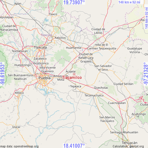
Tlacamilco GPS coordinates[2]
19° 4' 33.24" North, 97° 54' 59.04" West
| Map corner | latitude | longitude |
|---|---|---|
| Upper-left | 19.73907°, | -98.61953° |
| Center: | 19.0759°, | -97.9164° |
| Lower-right: | 18.41007°, | -97.21328° |
| Map W x H: | 147.8×147.8 km | = 91.8×91.8mi |
| max Lat: | 32.7° ⇑63.4% North |
| Tlacamilco: | 19.0759° |
| min Lat: | ⇓36.6% South 14.53588° |
| min Long | Tlacamilco | max Long |
| -117.105° | -97.9164° | -86.73105° |
| W 64.7%⇐ | ⇒35.3% E |
Elevation
Elevation of Tlacamilco is 2358 m = 7736 ft, and this is 1104.3 m = 3623 ft above average elevation for this country.
| Max E: |
3497 m = 11473 ft | 11.5% |
| Tlacamilco | 2358 m 7736 ft | |
| Avg. | 1253.7 m = 4113 ft | |
Min E: |
-1 m = -3 ft | 88.5% |
See also: Mexico elevation on elevation.city.
Geographical zone
Tlacamilco is located in North Torrid zone (between Equator and Tropic of Cancer). Distance of this Northern Tropic circle is 484.9 km =301.3 mi to North.| Distance of | km | miles | from Tlacamilco |
|---|---|---|---|
| North Pole | 7886 | 4900.1 | to North |
| Arctic Circle | 5280.1 | 3280.9 | to North |
| Tropic Cancer | 484.9 | 301.3 | to North |
| Equator | 2121 | 1317.9 | to South |


Nearby cities:
15 places around Tlacamilco: (largest is in red/bold)
• Acajete
5.5 km =3.4 mi,  316°
316°
• Apango de Zaragoza
2.6 km =1.6 mi,  251°
251°
• La Magdalena Tetela Morelos
4 km =2.5 mi,  221°
221°
• Los Reyes de Ocampo
8.6 km =5.3 mi,  108°
108°
• San Agustín Tlaxco
8.2 km =5.1 mi, 254°
• San Antonio Tlacamilco
2.1 km =1.3 mi, 224°
• San Bartolomé Hueyapan
5.8 km =3.6 mi,  194°
194°
• San Felipe Tenextepec
6.6 km =4.1 mi,  138°
138°
• San Jerónimo Ocotitla
7 km =4.3 mi, 224°
• San Lorenzo Joya de Rodríguez
7 km =4.3 mi, 109°
• San Miguel
6.4 km =4 mi,  97°
97°
• San Pedro la Joya
8.3 km =5.2 mi, 98°
• Santa María Nenetzintla
5.8 km =3.6 mi, 245°
• Tepatlaxco de Hidalgo
6 km =3.7 mi,  275°
275°
• Álvaro Obregón
5.6 km =3.5 mi,  164°
164°
Sources, notices
• [Note1] Compared only with cities in Mexico existing in our database
• [Src1] Map data: © OpenStreetMap contributors (CC-BY-SA)
• [Src2] Other city data from geonames.org with taken over terms of usage.
• [Src3] Geographical zone / Annual Mean Temperature by Robert A. Rohde @ Wikipedia
