La Noria Hidalgo geodata
La Noria Hidalgo (Puebla) is a populated place; located in Mexico in America/Mexico_City (GMT-6) time zone. With population of 918 people, there are 9506 cities with bigger population in this country. Compared to other cities in Mexico, 74.7% of cities are located further ↑North; 61.3% of cities are located further ←West and 55.3% of cities have higher elevation than La Noria Hidalgo. Note1


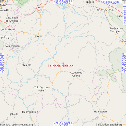
La Noria Hidalgo GPS coordinates[2]
18° 19' 7.464" North, 98° 11' 37.716" West
| Map corner | latitude | longitude |
|---|---|---|
| Upper-left | 18.98493°, | -98.89694° |
| Center: | 18.31874°, | -98.19381° |
| Lower-right: | 17.64997°, | -97.49069° |
| Map W x H: | 148.4×148.4 km | = 92.2×92.2mi |
| max Lat: | 32.7° ⇑74.7% North |
| La Noria Hidalgo: | 18.31874° |
| min Lat: | ⇓25.3% South 14.53588° |
| min Long | La Noria Hidalg | max Long |
| -117.105° | -98.19381° | -86.73105° |
| W 61.3%⇐ | ⇒38.7% E |
Elevation
Elevation of La Noria Hidalgo is 1185 m = 3888 ft, and this is 68.7 m = 225 ft below average elevation for this country.
| Max E: |
3497 m = 11473 ft | 55.3% |
| Avg. | 1253.7 m = 4113 ft | |
| La Noria Hidalgo | 1185 m = 3888 ft | |
Min E: |
-1 m = -3 ft | 44.7% |
See also: Mexico elevation on elevation.city.
Geographical zone
La Noria Hidalgo is located in North Torrid zone (between Equator and Tropic of Cancer). Distance of this Northern Tropic circle is 569.1 km =353.6 mi to North.| Distance of | km | miles | from La Noria Hidalgo |
|---|---|---|---|
| North Pole | 7970.2 | 4952.5 | to North |
| Arctic Circle | 5364.3 | 3333.2 | to North |
| Tropic Cancer | 569.1 | 353.6 | to North |
| Equator | 2036.9 | 1265.7 | to South |


Nearby cities:
15 places around La Noria Hidalgo: (largest is in red/bold)
• Ahuehuetitla
12.1 km =7.5 mi,  192°
192°
• Atopoltitlán
12.2 km =7.6 mi,  241°
241°
• Chinantla
15 km =9.3 mi,  209°
209°
• Garzones (Santa Gertrudis)
17.9 km =11.1 mi,  104°
104°
• Hermenegildo Galeana
11.9 km =7.4 mi,  125°
125°
• La Concepción
18.5 km =11.5 mi,  66°
66°
• Piaxtla
14.7 km =9.1 mi, 205°
• San Bernardo
15.1 km =9.4 mi,  141°
141°
• San Francisco Rancho Nuevo
15.5 km =9.6 mi,  115°
115°
• San Francisco de Asís
15.9 km =9.9 mi,  325°
325°
• San Pedro Cuayuca
18.2 km =11.3 mi,  3°
3°
• San Vicente Boquerón
15.2 km =9.4 mi,  106°
106°
• Santa Cruz Tejalpa
18.1 km =11.2 mi,  284°
284°
• Tehuitzingo
8.8 km =5.5 mi, 279°
• Tetelcingo
19.7 km =12.2 mi, 116°
Sources, notices
• [Note1] Compared only with cities in Mexico existing in our database
• [Src1] Map data: © OpenStreetMap contributors (CC-BY-SA)
• [Src2] Other city data from geonames.org with taken over terms of usage.
• [Src3] Geographical zone / Annual Mean Temperature by Robert A. Rohde @ Wikipedia
