Ahuehuetitla geodata
Ahuehuetitla (Puebla) is a populated place; located in Mexico in America/Mexico_City (GMT-6) time zone. With population of 1,210 people, there are 7193 cities with bigger population in this country. Compared to other cities in Mexico, 76% of cities are located further ↑North; 61% of cities are located further ←West and 54.9% of cities have higher elevation than Ahuehuetitla. Note1


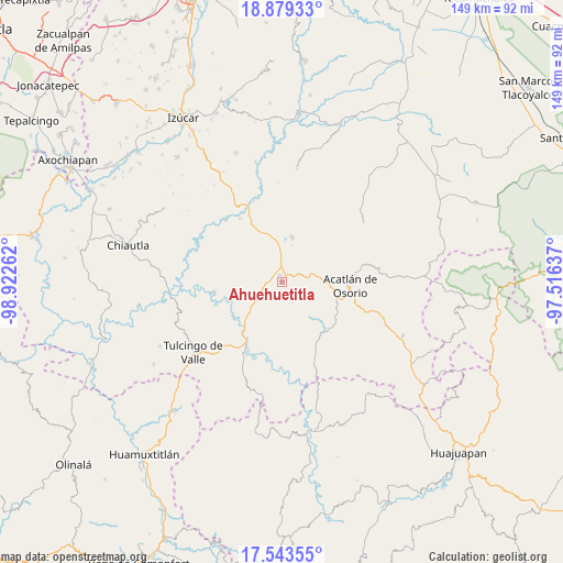
Ahuehuetitla GPS coordinates[2]
18° 12' 45.792" North, 98° 13' 10.164" West
| Map corner | latitude | longitude |
|---|---|---|
| Upper-left | 18.87933°, | -98.92262° |
| Center: | 18.21272°, | -98.21949° |
| Lower-right: | 17.54355°, | -97.51637° |
| Map W x H: | 148.5×148.5 km | = 92.3×92.3mi |
| max Lat: | 32.7° ⇑76% North |
| Ahuehuetitla: | 18.21272° |
| min Lat: | ⇓24% South 14.53588° |
| min Long | Ahuehuetitla | max Long |
| -117.105° | -98.21949° | -86.73105° |
| W 61%⇐ | ⇒39% E |
Elevation
Elevation of Ahuehuetitla is 1201 m = 3940 ft, and this is 52.7 m = 173 ft below average elevation for this country.
| Max E: |
3497 m = 11473 ft | 54.9% |
| Avg. | 1253.7 m = 4113 ft | |
| Ahuehuetitla | 1201 m = 3940 ft | |
Min E: |
-1 m = -3 ft | 45.1% |
See also: Mexico elevation on elevation.city.
Geographical zone
Ahuehuetitla is located in North Torrid zone (between Equator and Tropic of Cancer). Distance of this Northern Tropic circle is 580.9 km =361 mi to North.| Distance of | km | miles | from Ahuehuetitla |
|---|---|---|---|
| North Pole | 7982 | 4959.8 | to North |
| Arctic Circle | 5376.1 | 3340.6 | to North |
| Tropic Cancer | 580.9 | 361 | to North |
| Equator | 2025.1 | 1258.3 | to South |


Nearby cities:
15 places around Ahuehuetitla: (largest is in red/bold)
• Amatitlán de Azueta
15.6 km =9.7 mi,  104°
104°
• Atopoltitlán
10.1 km =6.3 mi,  306°
306°
• Chinantla
4.9 km =3 mi,  255°
255°
• Guadalupe Santa Ana
17.1 km =10.6 mi,  142°
142°
• Hermenegildo Galeana
13.3 km =8.3 mi,  68°
68°
• La Noria Hidalgo
12.1 km =7.5 mi,  12°
12°
• Mixquitepec
16.9 km =10.5 mi,  151°
151°
• Mixquitlixco
16.7 km =10.4 mi,  119°
119°
• Piaxtla
4 km =2.5 mi,  247°
247°
• San Bernardo
12.1 km =7.5 mi,  90°
90°
• San Francisco Rancho Nuevo
17.6 km =10.9 mi, 72°
• San Pablo Anicano
17.3 km =10.7 mi, 124°
• Tecomatlán
15.2 km =9.4 mi,  220°
220°
• Tehuitzingo
14.5 km =9 mi,  335°
335°
• Vista Hermosa
17.8 km =11.1 mi, 149°
Sources, notices
• [Note1] Compared only with cities in Mexico existing in our database
• [Src1] Map data: © OpenStreetMap contributors (CC-BY-SA)
• [Src2] Other city data from geonames.org with taken over terms of usage.
• [Src3] Geographical zone / Annual Mean Temperature by Robert A. Rohde @ Wikipedia
