Tenexcontitlán (El Ranchito) geodata
Tenexcontitlán (El Ranchito) (Guerrero) is a populated place; located in Mexico in America/Mexico_City (GMT-6) time zone. With population of 536 people, there are 15820 cities with bigger population in this country. Compared to other cities in Mexico, 70.5% of cities are located further ↑North; 59.7% of cities are located further →East and 62.3% of cities have lower elevation than Tenexcontitlán (El Ranchito). Note1
Current local time in Tenexcontitlán (El Ranchito):
07:20 AM, MondayDifference from your time zone: hours


Tenexcontitlán (El Ranchito) GPS coordinates[2]
18° 40' 26.184" North, 99° 39' 52.452" West
| Map corner | latitude | longitude |
|---|---|---|
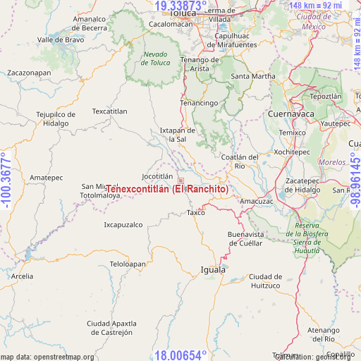
| Upper-left | 19.33873°, | -100.3677° |
| Center: | 18.67394°, | -99.66457° |
| Lower-right: | 18.00654°, | -98.96145° |
| Map W x H: | 148.1×148.1 km | = 92×92mi |
| max Lat: | 32.7° ⇑70.5% North |
| Tenexcontitlán (El Ranchito): | 18.67394° |
| min Lat: | ⇓29.5% South 14.53588° |
| min Long | Tenexcontitlán | max Long |
| -117.105° | -99.66457° | -86.73105° |
| W 40.3%⇐ | ⇒59.7% E |
Elevation
Elevation of Tenexcontitlán (El Ranchito) is 1764 m = 5787 ft, and this is 510.3 m = 1674 ft above average elevation for this country.
| Max E: |
3497 m = 11473 ft | 37.7% |
| Tenexcontitlán (El Ranchito) | 1764 m 5787 ft | |
| Avg. | 1253.7 m = 4113 ft | |
Min E: |
-1 m = -3 ft | 62.3% |
See also: Mexico elevation on elevation.city.
Geographical zone
Tenexcontitlán (El Ranchito) is located in North Torrid zone (between Equator and Tropic of Cancer). Distance of this Northern Tropic circle is 529.6 km =329.1 mi to North.| Distance of | km | miles | from Tenexcontitlán (El Ranchito) |
|---|---|---|---|
| North Pole | 7930.7 | 4927.9 | to North |
| Arctic Circle | 5324.8 | 3308.7 | to North |
| Tropic Cancer | 529.6 | 329.1 | to North |
| Equator | 2076.3 | 1290.2 | to South |


Nearby cities:
15 places around Tenexcontitlán (El Ranchito): (largest is in red/bold)
• Ahualulco
2.1 km =1.3 mi,  130°
130°
• Chontalcoatlán
9.8 km =6.1 mi,  102°
102°
• El Mogote
10.6 km =6.6 mi,  86°
86°
• El Terrero
13.1 km =8.1 mi,  8°
8°
• Huajojutla (El Azul)
14.3 km =8.9 mi,  137°
137°
• Jocotitlán
9.6 km =6 mi,  282°
282°
• La Concepción (La Concha)
10.8 km =6.7 mi,  344°
344°
• La Puerta de Santiago
11.1 km =6.9 mi,  22°
22°
• Malinaltenango
12.9 km =8 mi, 337°
• Piedra Parada
13.8 km =8.6 mi,  327°
327°
• Pilcaya
8.2 km =5.1 mi,  352°
352°
• San Andrés
6.3 km =3.9 mi,  117°
117°
• San Gregorio
8.9 km =5.5 mi, 123°
• Tetipac
3.4 km =2.1 mi,  148°
148°
• Zacualpan
12.8 km =8 mi,  293°
293°
Sources, notices
• [Note1] Compared only with cities in Mexico existing in our database
• [Src1] Map data: © OpenStreetMap contributors (CC-BY-SA)
• [Src2] Other city data from geonames.org with taken over terms of usage.
• [Src3] Geographical zone / Annual Mean Temperature by Robert A. Rohde @ Wikipedia
