Ceja Blanca geodata
Ceja Blanca (Guerrero) is a populated place; located in Mexico in America/Mexico_City (GMT-6) time zone. With population of 548 people, there are 15532 cities with bigger population in this country. Compared to other cities in Mexico, 75% of cities are located further ↑North; 57.8% of cities are located further →East and 63.5% of cities have higher elevation than Ceja Blanca. Note1


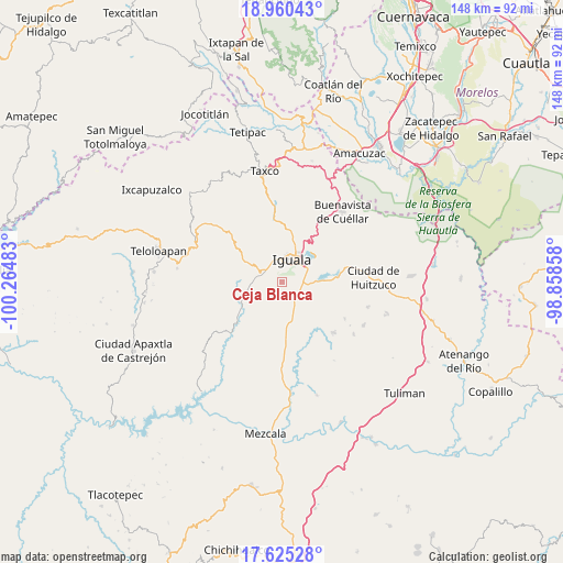
Ceja Blanca GPS coordinates[2]
18° 17' 38.904" North, 99° 33' 42.12" West
| Map corner | latitude | longitude |
|---|---|---|
| Upper-left | 18.96043°, | -100.26483° |
| Center: | 18.29414°, | -99.5617° |
| Lower-right: | 17.62528°, | -98.85858° |
| Map W x H: | 148.5×148.5 km | = 92.3×92.3mi |
| max Lat: | 32.7° ⇑75% North |
| Ceja Blanca: | 18.29414° |
| min Lat: | ⇓25% South 14.53588° |
| min Long | Ceja Blanca | max Long |
| -117.105° | -99.5617° | -86.73105° |
| W 42.2%⇐ | ⇒57.8% E |
Elevation
Elevation of Ceja Blanca is 787 m = 2582 ft, and this is 466.7 m = 1531 ft below average elevation for this country.
| Max E: |
3497 m = 11473 ft | 63.5% |
| Avg. | 1253.7 m = 4113 ft | |
| Ceja Blanca | 787 m = 2582 ft | |
Min E: |
-1 m = -3 ft | 36.5% |
See also: Mexico elevation on elevation.city.
Geographical zone
Ceja Blanca is located in North Torrid zone (between Equator and Tropic of Cancer). Distance of this Northern Tropic circle is 571.8 km =355.3 mi to North.| Distance of | km | miles | from Ceja Blanca |
|---|---|---|---|
| North Pole | 7972.9 | 4954.1 | to North |
| Arctic Circle | 5367.1 | 3335 | to North |
| Tropic Cancer | 571.8 | 355.3 | to North |
| Equator | 2034.1 | 1263.9 | to South |


Nearby cities:
15 places around Ceja Blanca: (largest is in red/bold)
• Acayahualco
11.5 km =7.1 mi,  131°
131°
• Ahuehuepan
10.7 km =6.6 mi,  298°
298°
• Colonia 15 de Septiembre
10.2 km =6.3 mi,  22°
22°
• Colonia Francisco Villa
10.5 km =6.5 mi, 22°
• Colonia Rancho del Cura (El Cura)
5.3 km =3.3 mi,  90°
90°
• Fermín Rabadán Cervantes
2.4 km =1.5 mi,  346°
346°
• Iguala de la Independencia
6.1 km =3.8 mi, 20°
• Metlapa
5.3 km =3.3 mi,  289°
289°
• Rincón de la Cocina
11.5 km =7.1 mi,  119°
119°
• Santa Teresa
9.2 km =5.7 mi,  141°
141°
• Tepecoacuilco de Trujano
10.3 km =6.4 mi, 94°
• Tepochica
4.1 km =2.5 mi,  76°
76°
• Tierra Colorada
9.3 km =5.8 mi,  107°
107°
• Tuxpan
10.6 km =6.6 mi,  54°
54°
• Zacacoyuca
6.1 km =3.8 mi, 143°
Sources, notices
• [Note1] Compared only with cities in Mexico existing in our database
• [Src1] Map data: © OpenStreetMap contributors (CC-BY-SA)
• [Src2] Other city data from geonames.org with taken over terms of usage.
• [Src3] Geographical zone / Annual Mean Temperature by Robert A. Rohde @ Wikipedia
