Topiltepec geodata
Topiltepec (Guerrero) is a populated place; located in Mexico in America/Mexico_City (GMT-6) time zone. With population of 2,496 people, there are 3539 cities with bigger population in this country. Compared to other cities in Mexico, 81.8% of cities are located further ↑North; 53.2% of cities are located further →East and 51.5% of cities have lower elevation than Topiltepec. Note1


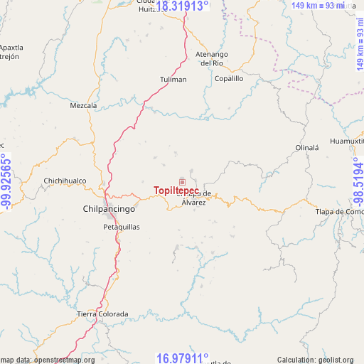
Topiltepec GPS coordinates[2]
17° 39' 1.332" North, 99° 13' 21.072" West
| Map corner | latitude | longitude |
|---|---|---|
| Upper-left | 18.31913°, | -99.92565° |
| Center: | 17.65037°, | -99.22252° |
| Lower-right: | 16.97911°, | -98.5194° |
| Map W x H: | 149×149 km | = 92.6×92.6mi |
| max Lat: | 32.7° ⇑81.8% North |
| Topiltepec: | 17.65037° |
| min Lat: | ⇓18.2% South 14.53588° |
| min Long | Topiltepec | max Long |
| -117.105° | -99.22252° | -86.73105° |
| W 46.8%⇐ | ⇒53.2% E |
Elevation
Elevation of Topiltepec is 1507 m = 4944 ft, and this is 253.3 m = 831 ft above average elevation for this country.
| Max E: |
3497 m = 11473 ft | 48.5% |
| Topiltepec | 1507 m 4944 ft | |
| Avg. | 1253.7 m = 4113 ft | |
Min E: |
-1 m = -3 ft | 51.5% |
See also: Mexico elevation on elevation.city.
Geographical zone
Topiltepec is located in North Torrid zone (between Equator and Tropic of Cancer). Distance of this Northern Tropic circle is 643.4 km =399.8 mi to North.| Distance of | km | miles | from Topiltepec |
|---|---|---|---|
| North Pole | 8044.5 | 4998.6 | to North |
| Arctic Circle | 5438.6 | 3379.4 | to North |
| Tropic Cancer | 643.4 | 399.8 | to North |
| Equator | 1962.5 | 1219.4 | to South |


Nearby cities:
15 places around Topiltepec: (largest is in red/bold)
• Acatlán
5.7 km =3.5 mi,  81°
81°
• Ahuihuiyuco
2.4 km =1.5 mi,  192°
192°
• Amate Amarillo
7.3 km =4.5 mi,  164°
164°
• Ayahualco
4.9 km =3 mi,  127°
127°
• Ayotzinapa
7.5 km =4.7 mi,  346°
346°
• Chilapa de Álvarez
7.7 km =4.8 mi,  137°
137°
• La Mohonera
2.5 km =1.6 mi,  121°
121°
• Las Trancas
6.2 km =3.9 mi,  357°
357°
• Lodo Grande
4.7 km =2.9 mi,  166°
166°
• Los Magueyes
5.9 km =3.7 mi,  114°
114°
• Mazatepec
1.7 km =1.1 mi,  19°
19°
• Pochahuizco
1.6 km =1 mi, 359°
• Tepehuisco
5.8 km =3.6 mi,  211°
211°
• Tepozcuautla
3.2 km =2 mi, 190°
• Zitlala
5.9 km =3.7 mi,  40°
40°
Sources, notices
• [Note1] Compared only with cities in Mexico existing in our database
• [Src1] Map data: © OpenStreetMap contributors (CC-BY-SA)
• [Src2] Other city data from geonames.org with taken over terms of usage.
• [Src3] Geographical zone / Annual Mean Temperature by Robert A. Rohde @ Wikipedia
