Las Trancas geodata
Las Trancas (Guerrero) is a populated place; located in Mexico in America/Mexico_City (GMT-6) time zone. With population of 655 people, there are 13244 cities with bigger population in this country. Compared to other cities in Mexico, 81.3% of cities are located further ↑North; 53.2% of cities are located further →East and 55.5% of cities have lower elevation than Las Trancas. Note1


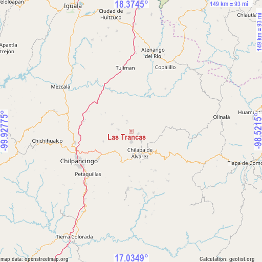
Las Trancas GPS coordinates[2]
17° 42' 21.42" North, 99° 13' 28.632" West
| Map corner | latitude | longitude |
|---|---|---|
| Upper-left | 18.3745°, | -99.92775° |
| Center: | 17.70595°, | -99.22462° |
| Lower-right: | 17.0349°, | -98.5215° |
| Map W x H: | 148.9×149 km | = 92.5×92.6mi |
| max Lat: | 32.7° ⇑81.3% North |
| Las Trancas: | 17.70595° |
| min Lat: | ⇓18.7% South 14.53588° |
| min Long | Las Trancas | max Long |
| -117.105° | -99.22462° | -86.73105° |
| W 46.8%⇐ | ⇒53.2% E |
Elevation
Elevation of Las Trancas is 1602 m = 5256 ft, and this is 348.3 m = 1143 ft above average elevation for this country.
| Max E: |
3497 m = 11473 ft | 44.5% |
| Las Trancas | 1602 m 5256 ft | |
| Avg. | 1253.7 m = 4113 ft | |
Min E: |
-1 m = -3 ft | 55.5% |
See also: Mexico elevation on elevation.city.
Geographical zone
Las Trancas is located in North Torrid zone (between Equator and Tropic of Cancer). Distance of this Northern Tropic circle is 637.2 km =395.9 mi to North.| Distance of | km | miles | from Las Trancas |
|---|---|---|---|
| North Pole | 8038.3 | 4994.8 | to North |
| Arctic Circle | 5432.5 | 3375.6 | to North |
| Tropic Cancer | 637.2 | 395.9 | to North |
| Equator | 1968.7 | 1223.3 | to South |


Nearby cities:
15 places around Las Trancas: (largest is in red/bold)
• Acatlán
7.9 km =4.9 mi,  132°
132°
• Ahuihuiyuco
8.5 km =5.3 mi,  181°
181°
• Ayahualco
10 km =6.2 mi,  155°
155°
• Ayotzinapa
1.9 km =1.2 mi,  307°
307°
• Hueyitlalpan
8.3 km =5.2 mi,  245°
245°
• La Esperanza
6.5 km =4 mi,  338°
338°
• La Mohonera
7.9 km =4.9 mi, 162°
• Mazatepec
4.7 km =2.9 mi,  170°
170°
• Pochahuizco
4.6 km =2.9 mi, 177°
• Rancho de las Lomas
4.4 km =2.7 mi,  329°
329°
• Tepozcuautla
9.3 km =5.8 mi, 182°
• Tlaltempanapa
6 km =3.7 mi,  56°
56°
• Topiltepec
6.2 km =3.9 mi, 177°
• Zitlala
4.4 km =2.7 mi,  113°
113°
• Zotoltitlán
7.2 km =4.5 mi,  277°
277°
Sources, notices
• [Note1] Compared only with cities in Mexico existing in our database
• [Src1] Map data: © OpenStreetMap contributors (CC-BY-SA)
• [Src2] Other city data from geonames.org with taken over terms of usage.
• [Src3] Geographical zone / Annual Mean Temperature by Robert A. Rohde @ Wikipedia
