Totozinapa geodata
Totozinapa (Veracruz) is a populated place; located in Mexico in America/Mexico_City (GMT-6) time zone. With population of 708 people, there are 12292 cities with bigger population in this country. Compared to other cities in Mexico, 62.6% of cities are located further ↑North; 72.8% of cities are located further ←West and 91.4% of cities have lower elevation than Totozinapa. Note1


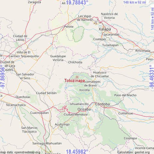
Totozinapa GPS coordinates[2]
19° 7' 31.656" North, 97° 9' 59.148" West
| Map corner | latitude | longitude |
|---|---|---|
| Upper-left | 19.78843°, | -97.86956° |
| Center: | 19.12546°, | -97.16643° |
| Lower-right: | 18.45982°, | -96.46331° |
| Map W x H: | 147.7×147.7 km | = 91.8×91.8mi |
| max Lat: | 32.7° ⇑62.6% North |
| Totozinapa: | 19.12546° |
| min Lat: | ⇓37.4% South 14.53588° |
| min Long | Totozinapa | max Long |
| -117.105° | -97.16643° | -86.73105° |
| W 72.8%⇐ | ⇒27.2% E |
Elevation
Elevation of Totozinapa is 2456 m = 8058 ft, and this is 1202.3 m = 3945 ft above average elevation for this country.
| Max E: |
3497 m = 11473 ft | 8.6% |
| Totozinapa | 2456 m 8058 ft | |
| Avg. | 1253.7 m = 4113 ft | |
Min E: |
-1 m = -3 ft | 91.4% |
See also: Mexico elevation on elevation.city.
Geographical zone
Totozinapa is located in North Torrid zone (between Equator and Tropic of Cancer). Distance of this Northern Tropic circle is 479.4 km =297.9 mi to North.| Distance of | km | miles | from Totozinapa |
|---|---|---|---|
| North Pole | 7880.5 | 4896.7 | to North |
| Arctic Circle | 5274.6 | 3277.5 | to North |
| Tropic Cancer | 479.4 | 297.9 | to North |
| Equator | 2126.6 | 1321.4 | to South |


Nearby cities:
15 places around Totozinapa: (largest is in red/bold)
• Acalocotla
8.2 km =5.1 mi,  45°
45°
• Alpatláhuac
7.7 km =4.8 mi,  94°
94°
• Ateopa
6.4 km =4 mi,  100°
100°
• Ayahualulco
4 km =2.5 mi,  126°
126°
• Calcahualco
8.5 km =5.3 mi, 92°
• Cocalzingo
6.8 km =4.2 mi,  119°
119°
• Cruz Verde
6.2 km =3.9 mi,  77°
77°
• El Potrerillo
7.4 km =4.6 mi,  178°
178°
• Excola
4.8 km =3 mi,  72°
72°
• Jesús María Acatla
8 km =5 mi,  25°
25°
• Nueva Vaquería
5.9 km =3.7 mi,  233°
233°
• Rincón de los Reyes
7.7 km =4.8 mi,  4°
4°
• San José Teacalco
7.3 km =4.5 mi, 101°
• Xacaxomulco
7.3 km =4.5 mi,  16°
16°
• Xilomichi
3 km =1.9 mi, 70°
Sources, notices
• [Note1] Compared only with cities in Mexico existing in our database
• [Src1] Map data: © OpenStreetMap contributors (CC-BY-SA)
• [Src2] Other city data from geonames.org with taken over terms of usage.
• [Src3] Geographical zone / Annual Mean Temperature by Robert A. Rohde @ Wikipedia
