El Potrerillo geodata
El Potrerillo (Veracruz) is a populated place; located in Mexico in America/Mexico_City (GMT-6) time zone. With population of 608 people, there are 14173 cities with bigger population in this country. Compared to other cities in Mexico, 63.7% of cities are located further ↑North; 72.8% of cities are located further ←West and 92.9% of cities have lower elevation than El Potrerillo. Note1


El Potrerillo GPS coordinates[2]
19° 3' 31.212" North, 97° 9' 51.228" West
| Map corner | latitude | longitude |
|---|---|---|
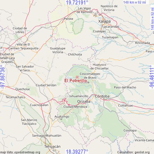
| Upper-left | 19.72191°, | -97.86736° |
| Center: | 19.05867°, | -97.16423° |
| Lower-right: | 18.39277°, | -96.46111° |
| Map W x H: | 147.8×147.8 km | = 91.8×91.8mi |
| max Lat: | 32.7° ⇑63.7% North |
| El Potrerillo: | 19.05867° |
| min Lat: | ⇓36.3% South 14.53588° |
| min Long | El Potrerillo | max Long |
| -117.105° | -97.16423° | -86.73105° |
| W 72.8%⇐ | ⇒27.2% E |
Elevation
Elevation of El Potrerillo is 2522 m = 8274 ft, and this is 1268.3 m = 4161 ft above average elevation for this country.
| Max E: |
3497 m = 11473 ft | 7.1% |
| El Potrerillo | 2522 m 8274 ft | |
| Avg. | 1253.7 m = 4113 ft | |
Min E: |
-1 m = -3 ft | 92.9% |
See also: Mexico elevation on elevation.city.
Geographical zone
El Potrerillo is located in North Torrid zone (between Equator and Tropic of Cancer). Distance of this Northern Tropic circle is 486.8 km =302.5 mi to North.| Distance of | km | miles | from El Potrerillo |
|---|---|---|---|
| North Pole | 7887.9 | 4901.3 | to North |
| Arctic Circle | 5282 | 3282.1 | to North |
| Tropic Cancer | 486.8 | 302.5 | to North |
| Equator | 2119.1 | 1316.7 | to South |


Nearby cities:
15 places around El Potrerillo: (largest is in red/bold)
• Ateopa
8.8 km =5.5 mi,  44°
44°
• Ayahualulco
5.9 km =3.7 mi,  30°
30°
• Chilapa
7.9 km =4.9 mi,  172°
172°
• Cocalzingo
7 km =4.3 mi,  54°
54°
• Cuiyachapa
1.8 km =1.1 mi,  216°
216°
• El Olvido (San Francisco)
6.2 km =3.9 mi,  122°
122°
• Huilotla
8.8 km =5.5 mi,  113°
113°
• La Lagunilla
6.8 km =4.2 mi, 174°
• Nueva Vaquería
6.4 km =4 mi,  308°
308°
• Tenixtepec
4.5 km =2.8 mi,  156°
156°
• Teteltzingo
2.2 km =1.4 mi, 111°
• Totozinapa
7.4 km =4.6 mi,  358°
358°
• Xilomichi
8.8 km =5.5 mi,  17°
17°
• Xocotla
8.2 km =5.1 mi,  126°
126°
• Zacatla
6.7 km =4.2 mi,  152°
152°
Sources, notices
• [Note1] Compared only with cities in Mexico existing in our database
• [Src1] Map data: © OpenStreetMap contributors (CC-BY-SA)
• [Src2] Other city data from geonames.org with taken over terms of usage.
• [Src3] Geographical zone / Annual Mean Temperature by Robert A. Rohde @ Wikipedia
