Huilotla geodata
Huilotla (Veracruz) is a populated place; located in Mexico in America/Mexico_City (GMT-6) time zone. With population of 719 people, there are 12132 cities with bigger population in this country. Compared to other cities in Mexico, 64.2% of cities are located further ↑North; 73.7% of cities are located further ←West and 68.8% of cities have lower elevation than Huilotla. Note1


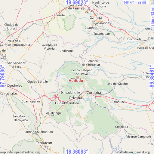
Huilotla GPS coordinates[2]
19° 1' 36.696" North, 97° 5' 15.828" West
| Map corner | latitude | longitude |
|---|---|---|
| Upper-left | 19.69023°, | -97.79086° |
| Center: | 19.02686°, | -97.08773° |
| Lower-right: | 18.36083°, | -96.38461° |
| Map W x H: | 147.8×147.8 km | = 91.8×91.8mi |
| max Lat: | 32.7° ⇑64.2% North |
| Huilotla: | 19.02686° |
| min Lat: | ⇓35.8% South 14.53588° |
| min Long | Huilotla | max Long |
| -117.105° | -97.08773° | -86.73105° |
| W 73.7%⇐ | ⇒26.3% E |
Elevation
Elevation of Huilotla is 1904 m = 6247 ft, and this is 650.3 m = 2134 ft above average elevation for this country.
| Max E: |
3497 m = 11473 ft | 31.2% |
| Huilotla | 1904 m 6247 ft | |
| Avg. | 1253.7 m = 4113 ft | |
Min E: |
-1 m = -3 ft | 68.8% |
See also: Mexico elevation on elevation.city.
Geographical zone
Huilotla is located in North Torrid zone (between Equator and Tropic of Cancer). Distance of this Northern Tropic circle is 490.3 km =304.7 mi to North.| Distance of | km | miles | from Huilotla |
|---|---|---|---|
| North Pole | 7891.5 | 4903.5 | to North |
| Arctic Circle | 5285.6 | 3284.3 | to North |
| Tropic Cancer | 490.3 | 304.7 | to North |
| Equator | 2115.6 | 1314.6 | to South |


Nearby cities:
15 places around Huilotla: (largest is in red/bold)
• Calaquioco
5.6 km =3.5 mi,  85°
85°
• Chocamán
6 km =3.7 mi,  105°
105°
• Contla
5.4 km =3.4 mi,  187°
187°
• El Olvido (San Francisco)
2.8 km =1.7 mi,  274°
274°
• Gonzalo Vázquez Vela
5 km =3.1 mi,  48°
48°
• Ixtayuca (San Nicolás)
4 km =2.5 mi,  15°
15°
• Metlac Solano (Metlac Segundo)
5.3 km =3.3 mi,  218°
218°
• Nicanor Espejo
5.8 km =3.6 mi, 47°
• Rincón Pintor
4.6 km =2.9 mi,  138°
138°
• Tetla
5.2 km =3.2 mi,  147°
147°
• Tetlaxco
2.9 km =1.8 mi,  58°
58°
• Xalatlaco
5.5 km =3.4 mi, 62°
• Xocotla
1.9 km =1.2 mi,  226°
226°
• Xonotzintla
5.6 km =3.5 mi,  123°
123°
• Zacatla
5.5 km =3.4 mi,  243°
243°
Sources, notices
• [Note1] Compared only with cities in Mexico existing in our database
• [Src1] Map data: © OpenStreetMap contributors (CC-BY-SA)
• [Src2] Other city data from geonames.org with taken over terms of usage.
• [Src3] Geographical zone / Annual Mean Temperature by Robert A. Rohde @ Wikipedia
