Paraje Nuevo geodata
Paraje Nuevo (Veracruz) is a populated place; located in Mexico in America/Mexico_City (GMT-6) time zone. With population of 4,465 people, there are 2062 cities with bigger population in this country. Compared to other cities in Mexico, 67.5% of cities are located further ↑North; 76.6% of cities are located further ←West and 65.5% of cities have higher elevation than Paraje Nuevo. Note1


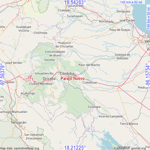
Paraje Nuevo GPS coordinates[2]
18° 52' 43.896" North, 96° 51' 38.376" West
| Map corner | latitude | longitude |
|---|---|---|
| Upper-left | 19.54283°, | -97.56379° |
| Center: | 18.87886°, | -96.86066° |
| Lower-right: | 18.21225°, | -96.15754° |
| Map W x H: | 147.9×147.9 km | = 91.9×91.9mi |
| max Lat: | 32.7° ⇑67.5% North |
| Paraje Nuevo: | 18.87886° |
| min Lat: | ⇓32.5% South 14.53588° |
| min Long | Paraje Nuevo | max Long |
| -117.105° | -96.86066° | -86.73105° |
| W 76.6%⇐ | ⇒23.4% E |
Elevation
Elevation of Paraje Nuevo is 661 m = 2169 ft, and this is 592.7 m = 1945 ft below average elevation for this country.
| Max E: |
3497 m = 11473 ft | 65.5% |
| Avg. | 1253.7 m = 4113 ft | |
| Paraje Nuevo | 661 m = 2169 ft | |
Min E: |
-1 m = -3 ft | 34.5% |
See also: Mexico elevation on elevation.city.
Geographical zone
Paraje Nuevo is located in North Torrid zone (between Equator and Tropic of Cancer). Distance of this Northern Tropic circle is 506.8 km =314.9 mi to North.| Distance of | km | miles | from Paraje Nuevo |
|---|---|---|---|
| North Pole | 7907.9 | 4913.7 | to North |
| Arctic Circle | 5302 | 3294.5 | to North |
| Tropic Cancer | 506.8 | 314.9 | to North |
| Equator | 2099.1 | 1304.3 | to South |


Nearby cities:
15 places around Paraje Nuevo: (largest is in red/bold)
• Agustín Millán
6.3 km =3.9 mi,  277°
277°
• Amatlán de los Reyes
6.8 km =4.2 mi,  238°
238°
• Cacahuatal
5.7 km =3.5 mi,  159°
159°
• Cuauhtémoc
3.9 km =2.4 mi,  261°
261°
• Córdoba
6.9 km =4.3 mi,  274°
274°
• Ex-hacienda la Concepción
5.1 km =3.2 mi,  131°
131°
• General Francisco Paz (El Poblado)
7.1 km =4.4 mi,  124°
124°
• General Miguel Alemán
7.4 km =4.6 mi,  77°
77°
• Ignacio Zaragoza
5.1 km =3.2 mi,  32°
32°
• Manuel León
3 km =1.9 mi,  201°
201°
• Peñuela
3.8 km =2.4 mi, 244°
• Potrero Viejo
1.8 km =1.1 mi,  95°
95°
• San Antonio Fraternidad
4.3 km =2.7 mi,  150°
150°
• San Rafael Río Seco
2.2 km =1.4 mi, 261°
• Venta Parada
3.2 km =2 mi, 159°
Sources, notices
• [Note1] Compared only with cities in Mexico existing in our database
• [Src1] Map data: © OpenStreetMap contributors (CC-BY-SA)
• [Src2] Other city data from geonames.org with taken over terms of usage.
• [Src3] Geographical zone / Annual Mean Temperature by Robert A. Rohde @ Wikipedia
