Venta Parada geodata
Venta Parada (Veracruz) is a populated place; located in Mexico in America/Mexico_City (GMT-6) time zone. With population of 536 people, there are 15820 cities with bigger population in this country. Compared to other cities in Mexico, 67.9% of cities are located further ↑North; 76.7% of cities are located further ←West and 66.3% of cities have higher elevation than Venta Parada. Note1


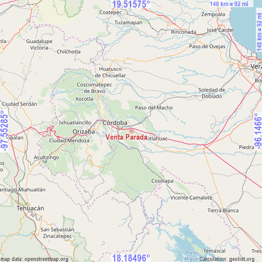
Venta Parada GPS coordinates[2]
18° 51' 6.012" North, 96° 50' 58.992" West
| Map corner | latitude | longitude |
|---|---|---|
| Upper-left | 19.51575°, | -97.55285° |
| Center: | 18.85167°, | -96.84972° |
| Lower-right: | 18.18496°, | -96.1466° |
| Map W x H: | 148×148 km | = 92×92mi |
| max Lat: | 32.7° ⇑67.9% North |
| Venta Parada: | 18.85167° |
| min Lat: | ⇓32.1% South 14.53588° |
| min Long | Venta Parada | max Long |
| -117.105° | -96.84972° | -86.73105° |
| W 76.7%⇐ | ⇒23.3% E |
Elevation
Elevation of Venta Parada is 623 m = 2044 ft, and this is 630.7 m = 2069 ft below average elevation for this country.
| Max E: |
3497 m = 11473 ft | 66.3% |
| Avg. | 1253.7 m = 4113 ft | |
| Venta Parada | 623 m = 2044 ft | |
Min E: |
-1 m = -3 ft | 33.7% |
See also: Mexico elevation on elevation.city.
Geographical zone
Venta Parada is located in North Torrid zone (between Equator and Tropic of Cancer). Distance of this Northern Tropic circle is 509.8 km =316.8 mi to North.| Distance of | km | miles | from Venta Parada |
|---|---|---|---|
| North Pole | 7911 | 4915.7 | to North |
| Arctic Circle | 5305.1 | 3296.4 | to North |
| Tropic Cancer | 509.8 | 316.8 | to North |
| Equator | 2096.1 | 1302.5 | to South |


Nearby cities:
15 places around Venta Parada: (largest is in red/bold)
• Amatlán de los Reyes
7 km =4.3 mi,  265°
265°
• Cacahuatal
2.4 km =1.5 mi,  160°
160°
• Cuauhtémoc
5.6 km =3.5 mi,  296°
296°
• Ex-hacienda la Concepción
2.7 km =1.7 mi,  97°
97°
• General Alatriste (San Joaquín)
6 km =3.7 mi, 102°
• General Francisco Paz (El Poblado)
4.8 km =3 mi, 102°
• General Juan José Baz (San José del Corral)
4.7 km =2.9 mi,  135°
135°
• La Loma de Guadalupe
5.1 km =3.2 mi, 143°
• Manuel León
2.3 km =1.4 mi,  275°
275°
• Paraje Nuevo
3.2 km =2 mi,  339°
339°
• Peñuela
4.8 km =3 mi,  287°
287°
• Potrero Viejo
2.9 km =1.8 mi,  12°
12°
• San Antonio Fraternidad
1.2 km =0.7 mi,  128°
128°
• San Rafael Río Seco
4.3 km =2.7 mi,  309°
309°
• Yanga
5.8 km =3.6 mi,  111°
111°
Sources, notices
• [Note1] Compared only with cities in Mexico existing in our database
• [Src1] Map data: © OpenStreetMap contributors (CC-BY-SA)
• [Src2] Other city data from geonames.org with taken over terms of usage.
• [Src3] Geographical zone / Annual Mean Temperature by Robert A. Rohde @ Wikipedia
