Cotlaixco geodata
Cotlaixco (Veracruz) is a populated place; located in Mexico in America/Mexico_City (GMT-6) time zone. With population of 520 people, there are 16208 cities with bigger population in this country. Compared to other cities in Mexico, 69.2% of cities are located further ↑North; 75.5% of cities are located further ←West and 54.3% of cities have higher elevation than Cotlaixco. Note1


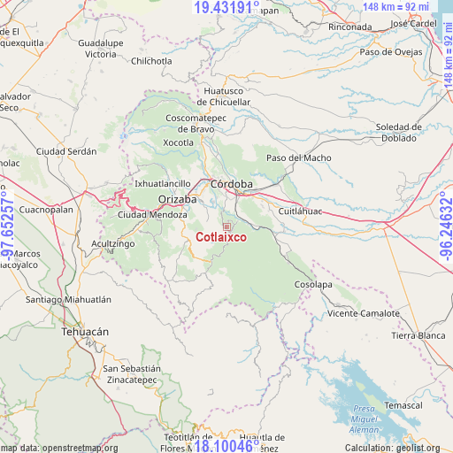
Cotlaixco GPS coordinates[2]
18° 46' 3" North, 96° 56' 57.984" West
| Map corner | latitude | longitude |
|---|---|---|
| Upper-left | 19.43191°, | -97.65257° |
| Center: | 18.7675°, | -96.94944° |
| Lower-right: | 18.10046°, | -96.24632° |
| Map W x H: | 148×148 km | = 92×92mi |
| max Lat: | 32.7° ⇑69.2% North |
| Cotlaixco: | 18.7675° |
| min Lat: | ⇓30.8% South 14.53588° |
| min Long | Cotlaixco | max Long |
| -117.105° | -96.94944° | -86.73105° |
| W 75.5%⇐ | ⇒24.5% E |
Elevation
Elevation of Cotlaixco is 1226 m = 4022 ft, and this is 27.7 m = 91 ft below average elevation for this country.
| Max E: |
3497 m = 11473 ft | 54.3% |
| Avg. | 1253.7 m = 4113 ft | |
| Cotlaixco | 1226 m = 4022 ft | |
Min E: |
-1 m = -3 ft | 45.7% |
See also: Mexico elevation on elevation.city.
Geographical zone
Cotlaixco is located in North Torrid zone (between Equator and Tropic of Cancer). Distance of this Northern Tropic circle is 519.2 km =322.6 mi to North.| Distance of | km | miles | from Cotlaixco |
|---|---|---|---|
| North Pole | 7920.3 | 4921.4 | to North |
| Arctic Circle | 5314.4 | 3302.2 | to North |
| Tropic Cancer | 519.2 | 322.6 | to North |
| Equator | 2086.8 | 1296.7 | to South |


Nearby cities:
15 places around Cotlaixco: (largest is in red/bold)
• Choapa
3.7 km =2.3 mi,  201°
201°
• Coetzala
3.9 km =2.4 mi,  60°
60°
• Coetzapotitla
2.1 km =1.3 mi,  117°
117°
• Cuesta del Mexicano
5.9 km =3.7 mi,  314°
314°
• El Campanario
2.9 km =1.8 mi,  266°
266°
• Emiliano Zapata
2.3 km =1.4 mi,  148°
148°
• Guadalupe
6 km =3.7 mi,  26°
26°
• Naranjal
5 km =3.1 mi,  343°
343°
• Poxcautla
4 km =2.5 mi,  228°
228°
• Rincón de Maravillas
5.4 km =3.4 mi,  290°
290°
• San José Independencia
1.4 km =0.9 mi,  160°
160°
• San Sebastián
4.7 km =2.9 mi,  167°
167°
• Teotzacualco
6.1 km =3.8 mi, 225°
• Tlecuaxco
4.7 km =2.9 mi,  257°
257°
• Villa Libertad
5.3 km =3.3 mi,  351°
351°
Sources, notices
• [Note1] Compared only with cities in Mexico existing in our database
• [Src1] Map data: © OpenStreetMap contributors (CC-BY-SA)
• [Src2] Other city data from geonames.org with taken over terms of usage.
• [Src3] Geographical zone / Annual Mean Temperature by Robert A. Rohde @ Wikipedia
