Coetzala geodata
Coetzala (Veracruz) is a seat of a second-order administrative division; located in Mexico in America/Mexico_City (GMT-6) time zone. With population of 1,250 people, there are 6944 cities with bigger population in this country. Compared to other cities in Mexico, 68.9% of cities are located further ↑North; 75.9% of cities are located further ←West and 65.8% of cities have higher elevation than Coetzala. Note1


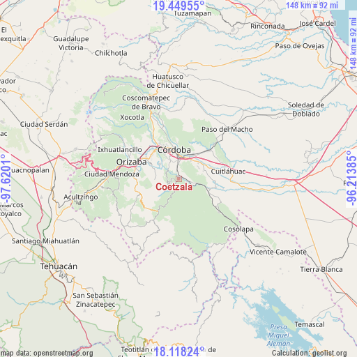
Coetzala GPS coordinates[2]
18° 47' 6.756" North, 96° 55' 1.092" West
| Map corner | latitude | longitude |
|---|---|---|
| Upper-left | 19.44955°, | -97.6201° |
| Center: | 18.78521°, | -96.91697° |
| Lower-right: | 18.11824°, | -96.21385° |
| Map W x H: | 148×148 km | = 92×92mi |
| max Lat: | 32.7° ⇑68.9% North |
| Coetzala: | 18.78521° |
| min Lat: | ⇓31.1% South 14.53588° |
| min Long | Coetzala | max Long |
| -117.105° | -96.91697° | -86.73105° |
| W 75.9%⇐ | ⇒24.1% E |
Elevation
Elevation of Coetzala is 648 m = 2126 ft, and this is 605.7 m = 1987 ft below average elevation for this country.
| Max E: |
3497 m = 11473 ft | 65.8% |
| Avg. | 1253.7 m = 4113 ft | |
| Coetzala | 648 m = 2126 ft | |
Min E: |
-1 m = -3 ft | 34.2% |
See also: Mexico elevation on elevation.city.
Geographical zone
Coetzala is located in North Torrid zone (between Equator and Tropic of Cancer). Distance of this Northern Tropic circle is 517.2 km =321.4 mi to North.| Distance of | km | miles | from Coetzala |
|---|---|---|---|
| North Pole | 7918.3 | 4920.2 | to North |
| Arctic Circle | 5312.5 | 3301 | to North |
| Tropic Cancer | 517.2 | 321.4 | to North |
| Equator | 2088.7 | 1297.9 | to South |


Nearby cities:
15 places around Coetzala: (largest is in red/bold)
• Amatlán de los Reyes
6.8 km =4.2 mi,  0°
0°
• Barrio Guadalupe
4.6 km =2.9 mi,  87°
87°
• Centro de Readaptación Social
6.3 km =3.9 mi,  338°
338°
• Coetzapotitla
3.3 km =2.1 mi,  207°
207°
• Cotlaixco
3.9 km =2.4 mi,  240°
240°
• Cuichapa
5.3 km =3.3 mi,  106°
106°
• El Campanario
6.6 km =4.1 mi,  251°
251°
• El Otate
3 km =1.9 mi,  49°
49°
• Emiliano Zapata
4.5 km =2.8 mi, 209°
• Guadalupe
3.5 km =2.2 mi,  346°
346°
• Naranjal
5.6 km =3.5 mi,  300°
300°
• Rincón de Buena Vista
6.1 km =3.8 mi,  122°
122°
• San José Independencia
4.4 km =2.7 mi,  222°
222°
• Tenejápam de Mata
4.1 km =2.5 mi, 111°
• Villa Libertad
5.3 km =3.3 mi,  307°
307°
Sources, notices
• [Note1] Compared only with cities in Mexico existing in our database
• [Src1] Map data: © OpenStreetMap contributors (CC-BY-SA)
• [Src2] Other city data from geonames.org with taken over terms of usage.
• [Src3] Geographical zone / Annual Mean Temperature by Robert A. Rohde @ Wikipedia
