Emiliano Zapata geodata
Emiliano Zapata (Veracruz) is a populated place; located in Mexico in America/Mexico_City (GMT-6) time zone. With population of 501 people, there are 16785 cities with bigger population in this country. Compared to other cities in Mexico, 69.5% of cities are located further ↑North; 75.7% of cities are located further ←West and 53.7% of cities have higher elevation than Emiliano Zapata. Note1


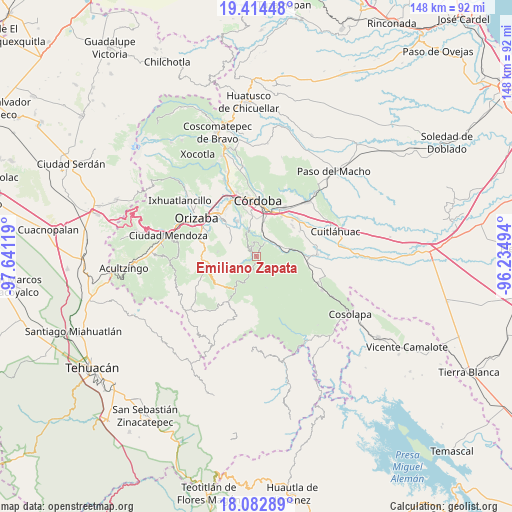
Emiliano Zapata GPS coordinates[2]
18° 45' 0" North, 96° 56' 17.016" West
| Map corner | latitude | longitude |
|---|---|---|
| Upper-left | 19.41448°, | -97.64119° |
| Center: | 18.75°, | -96.93806° |
| Lower-right: | 18.08289°, | -96.23494° |
| Map W x H: | 148.1×148.1 km | = 92×92mi |
| max Lat: | 32.7° ⇑69.5% North |
| Emiliano Zapata: | 18.75° |
| min Lat: | ⇓30.5% South 14.53588° |
| min Long | Emiliano Zapata | max Long |
| -117.105° | -96.93806° | -86.73105° |
| W 75.7%⇐ | ⇒24.3% E |
Elevation
Elevation of Emiliano Zapata is 1261 m = 4137 ft, and this is 7.3 m = 24 ft above average elevation for this country.
| Max E: |
3497 m = 11473 ft | 53.7% |
| Emiliano Zapata | 1261 m 4137 ft | |
| Avg. | 1253.7 m = 4113 ft | |
Min E: |
-1 m = -3 ft | 46.3% |
See also: Mexico elevation on elevation.city.
Geographical zone
Emiliano Zapata is located in North Torrid zone (between Equator and Tropic of Cancer). Distance of this Northern Tropic circle is 521.1 km =323.8 mi to North.| Distance of | km | miles | from Emiliano Zapata |
|---|---|---|---|
| North Pole | 7922.3 | 4922.7 | to North |
| Arctic Circle | 5316.4 | 3303.5 | to North |
| Tropic Cancer | 521.1 | 323.8 | to North |
| Equator | 2084.8 | 1295.4 | to South |


Nearby cities:
15 places around Emiliano Zapata: (largest is in red/bold)
• Choapa
3 km =1.9 mi,  238°
238°
• Coetzala
4.5 km =2.8 mi,  29°
29°
• Coetzapotitla
1.2 km =0.7 mi, 34°
• Cotlaixco
2.3 km =1.4 mi,  328°
328°
• El Campanario
4.4 km =2.7 mi,  293°
293°
• Guadalupe
7.4 km =4.6 mi,  11°
11°
• Naranjal
7.2 km =4.5 mi,  338°
338°
• Poxcautla
4.3 km =2.7 mi,  260°
260°
• Rincón de Buena Vista
7.3 km =4.5 mi,  85°
85°
• Rincón de Maravillas
7.3 km =4.5 mi,  301°
301°
• San José Independencia
1 km =0.6 mi,  311°
311°
• San Sebastián
2.6 km =1.6 mi,  183°
183°
• Tenejápam de Mata
6.5 km =4 mi,  67°
67°
• Teotzacualco
6 km =3.7 mi,  246°
246°
• Tlecuaxco
5.8 km =3.6 mi,  279°
279°
Sources, notices
• [Note1] Compared only with cities in Mexico existing in our database
• [Src1] Map data: © OpenStreetMap contributors (CC-BY-SA)
• [Src2] Other city data from geonames.org with taken over terms of usage.
• [Src3] Geographical zone / Annual Mean Temperature by Robert A. Rohde @ Wikipedia
