Villa Libertad geodata
Villa Libertad (Veracruz) is a populated place; located in Mexico in America/Mexico_City (GMT-6) time zone. With population of 690 people, there are 12606 cities with bigger population in this country. Compared to other cities in Mexico, 68.5% of cities are located further ↑North; 75.5% of cities are located further ←West and 64.3% of cities have higher elevation than Villa Libertad. Note1


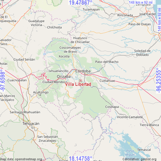
Villa Libertad GPS coordinates[2]
18° 48' 51.984" North, 96° 57' 24.012" West
| Map corner | latitude | longitude |
|---|---|---|
| Upper-left | 19.47867°, | -97.6598° |
| Center: | 18.81444°, | -96.95667° |
| Lower-right: | 18.14758°, | -96.25355° |
| Map W x H: | 148×148 km | = 92×92mi |
| max Lat: | 32.7° ⇑68.5% North |
| Villa Libertad: | 18.81444° |
| min Lat: | ⇓31.5% South 14.53588° |
| min Long | Villa Libertad | max Long |
| -117.105° | -96.95667° | -86.73105° |
| W 75.5%⇐ | ⇒24.5% E |
Elevation
Elevation of Villa Libertad is 729 m = 2392 ft, and this is 524.7 m = 1721 ft below average elevation for this country.
| Max E: |
3497 m = 11473 ft | 64.3% |
| Avg. | 1253.7 m = 4113 ft | |
| Villa Libertad | 729 m = 2392 ft | |
Min E: |
-1 m = -3 ft | 35.7% |
See also: Mexico elevation on elevation.city.
Geographical zone
Villa Libertad is located in North Torrid zone (between Equator and Tropic of Cancer). Distance of this Northern Tropic circle is 513.9 km =319.3 mi to North.| Distance of | km | miles | from Villa Libertad |
|---|---|---|---|
| North Pole | 7915.1 | 4918.2 | to North |
| Arctic Circle | 5309.2 | 3299 | to North |
| Tropic Cancer | 513.9 | 319.3 | to North |
| Equator | 2092 | 1299.9 | to South |


Nearby cities:
15 places around Villa Libertad: (largest is in red/bold)
• Amatlán de los Reyes
5.6 km =3.5 mi,  50°
50°
• Centro de Readaptación Social
3.2 km =2 mi,  34°
34°
• Coetzala
5.3 km =3.3 mi,  127°
127°
• Cotlaixco
5.3 km =3.3 mi,  171°
171°
• Cuesta del Mexicano
3.6 km =2.2 mi,  252°
252°
• El Campanario
5.8 km =3.6 mi,  201°
201°
• Fresnal
2.8 km =1.7 mi,  277°
277°
• Guadalupe
3.4 km =2.1 mi,  87°
87°
• Naranjal
0.8 km =0.5 mi,  237°
237°
• Rincón de Maravillas
5.5 km =3.4 mi,  231°
231°
• San José de Tapia
3.7 km =2.3 mi,  4°
4°
• Trapiche Viejo
3.4 km =2.1 mi,  20°
20°
• Veinte de Noviembre
5.6 km =3.5 mi, 2°
• Villa Unión
5.2 km =3.2 mi,  328°
328°
• Zapoapan
4.8 km =3 mi,  306°
306°
Sources, notices
• [Note1] Compared only with cities in Mexico existing in our database
• [Src1] Map data: © OpenStreetMap contributors (CC-BY-SA)
• [Src2] Other city data from geonames.org with taken over terms of usage.
• [Src3] Geographical zone / Annual Mean Temperature by Robert A. Rohde @ Wikipedia
