Dos Ríos geodata
Dos Ríos (Veracruz) is a populated place; located in Mexico in America/Mexico_City (GMT-6) time zone. With population of 4,825 people, there are 1920 cities with bigger population in this country. Compared to other cities in Mexico, 65.9% of cities are located further ↑North; 74.5% of cities are located further ←West and 54.5% of cities have higher elevation than Dos Ríos. Note1


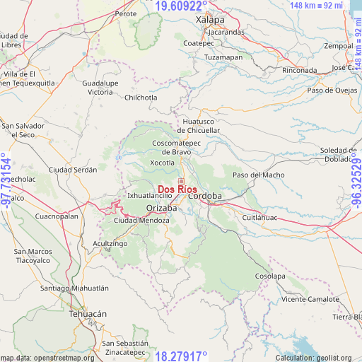
Dos Ríos GPS coordinates[2]
18° 56' 43.872" North, 97° 1' 42.276" West
| Map corner | latitude | longitude |
|---|---|---|
| Upper-left | 19.60922°, | -97.73154° |
| Center: | 18.94552°, | -97.02841° |
| Lower-right: | 18.27917°, | -96.32529° |
| Map W x H: | 147.9×147.9 km | = 91.9×91.9mi |
| max Lat: | 32.7° ⇑65.9% North |
| Dos Ríos: | 18.94552° |
| min Lat: | ⇓34.1% South 14.53588° |
| min Long | Dos Ríos | max Long |
| -117.105° | -97.02841° | -86.73105° |
| W 74.5%⇐ | ⇒25.5% E |
Elevation
Elevation of Dos Ríos is 1220 m = 4003 ft, and this is 33.7 m = 111 ft below average elevation for this country.
| Max E: |
3497 m = 11473 ft | 54.5% |
| Avg. | 1253.7 m = 4113 ft | |
| Dos Ríos | 1220 m = 4003 ft | |
Min E: |
-1 m = -3 ft | 45.5% |
See also: Mexico elevation on elevation.city.
Geographical zone
Dos Ríos is located in North Torrid zone (between Equator and Tropic of Cancer). Distance of this Northern Tropic circle is 499.4 km =310.3 mi to North.| Distance of | km | miles | from Dos Ríos |
|---|---|---|---|
| North Pole | 7900.5 | 4909.1 | to North |
| Arctic Circle | 5294.6 | 3289.9 | to North |
| Tropic Cancer | 499.4 | 310.3 | to North |
| Equator | 2106.5 | 1308.9 | to South |


Nearby cities:
15 places around Dos Ríos: (largest is in red/bold)
• Cumbre de Metlac
2.2 km =1.4 mi,  173°
173°
• El Palenque Palotal
5.7 km =3.5 mi,  64°
64°
• Fortín de las Flores
5.1 km =3.2 mi,  144°
144°
• Fraccionamiento Villas de la Llave
5.1 km =3.2 mi,  130°
130°
• La Palma (Tercera Manzana del Barreal)
4.7 km =2.9 mi,  96°
96°
• La Sidra
5.6 km =3.5 mi,  256°
256°
• Lagunilla
4.8 km =3 mi,  216°
216°
• Monte Blanco
2.6 km =1.6 mi,  27°
27°
• Monte Salas
1.4 km =0.9 mi, 131°
• Moyoapan
3.7 km =2.3 mi,  209°
209°
• Santa Lucía Potrerillo
2.7 km =1.7 mi,  9°
9°
• Santa Martina
5.7 km =3.5 mi,  114°
114°
• Sumidero
4.7 km =2.9 mi, 171°
• Tetla
5.7 km =3.5 mi,  323°
323°
• Tocuila
1.3 km =0.8 mi,  68°
68°
Sources, notices
• [Note1] Compared only with cities in Mexico existing in our database
• [Src1] Map data: © OpenStreetMap contributors (CC-BY-SA)
• [Src2] Other city data from geonames.org with taken over terms of usage.
• [Src3] Geographical zone / Annual Mean Temperature by Robert A. Rohde @ Wikipedia
