Cerro de la Palma geodata
Cerro de la Palma (Veracruz) is a populated place; located in Mexico in America/Mexico_City (GMT-6) time zone. With population of 714 people, there are 12202 cities with bigger population in this country. Compared to other cities in Mexico, 76.6% of cities are located further ↑North; 85% of cities are located further ←West and 76.5% of cities have higher elevation than Cerro de la Palma. Note1


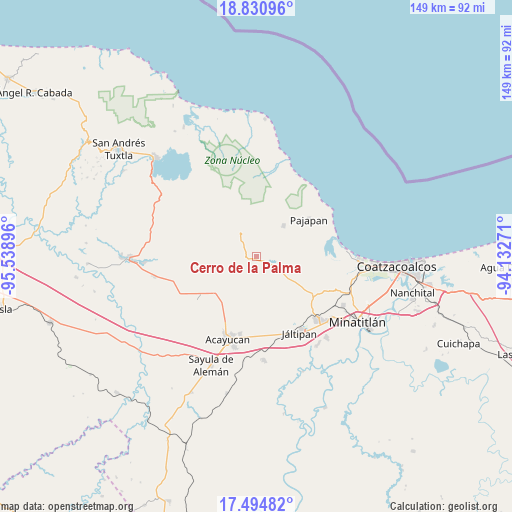
Cerro de la Palma GPS coordinates[2]
18° 9' 51.012" North, 94° 50' 8.988" West
| Map corner | latitude | longitude |
|---|---|---|
| Upper-left | 18.83096°, | -95.53896° |
| Center: | 18.16417°, | -94.83583° |
| Lower-right: | 17.49482°, | -94.13271° |
| Map W x H: | 148.6×148.6 km | = 92.3×92.3mi |
| max Lat: | 32.7° ⇑76.6% North |
| Cerro de la Palma: | 18.16417° |
| min Lat: | ⇓23.4% South 14.53588° |
| min Long | Cerro de la Pal | max Long |
| -117.105° | -94.83583° | -86.73105° |
| W 85%⇐ | ⇒15% E |
Elevation
Elevation of Cerro de la Palma is 168 m = 551 ft, and this is 1085.7 m = 3562 ft below average elevation for this country.
| Max E: |
3497 m = 11473 ft | 76.5% |
| Avg. | 1253.7 m = 4113 ft | |
| Cerro de la Palma | 168 m = 551 ft | |
Min E: |
-1 m = -3 ft | 23.5% |
See also: Mexico elevation on elevation.city.
Geographical zone
Cerro de la Palma is located in North Torrid zone (between Equator and Tropic of Cancer). Distance of this Northern Tropic circle is 586.3 km =364.3 mi to North.| Distance of | km | miles | from Cerro de la Palma |
|---|---|---|---|
| North Pole | 7987.4 | 4963.1 | to North |
| Arctic Circle | 5381.5 | 3343.9 | to North |
| Tropic Cancer | 586.3 | 364.3 | to North |
| Equator | 2019.7 | 1255 | to South |


Nearby cities:
15 places around Cerro de la Palma: (largest is in red/bold)
• Amamaloya
3.4 km =2.1 mi,  119°
119°
• Cuilonia Nuevo
8.4 km =5.2 mi,  262°
262°
• El Naranjo
7.4 km =4.6 mi,  113°
113°
• Huazuntlán
4.6 km =2.9 mi,  100°
100°
• Ixhuapán
4.1 km =2.5 mi,  71°
71°
• La Estribera
7.7 km =4.8 mi,  226°
226°
• Las Palomas (Bajo Paloma)
7.1 km =4.4 mi,  254°
254°
• Mecayapan
6.2 km =3.9 mi,  357°
357°
• Minzapan
11.8 km =7.3 mi, 103°
• Ocotal Chico
10.7 km =6.6 mi,  345°
345°
• Saltillo
1.9 km =1.2 mi, 252°
• San Andrés Chamilpa
8.3 km =5.2 mi,  193°
193°
• Soteapan
8.7 km =5.4 mi,  333°
333°
• Tatahuicapan
12.1 km =7.5 mi,  40°
40°
• Tonalapa
4.8 km =3 mi, 110°
Sources, notices
• [Note1] Compared only with cities in Mexico existing in our database
• [Src1] Map data: © OpenStreetMap contributors (CC-BY-SA)
• [Src2] Other city data from geonames.org with taken over terms of usage.
• [Src3] Geographical zone / Annual Mean Temperature by Robert A. Rohde @ Wikipedia
