Estero de Milpas geodata
Estero de Milpas (Veracruz) is a populated place; located in Mexico in America/Mexico_City (GMT-6) time zone. With population of 1,529 people, there are 5646 cities with bigger population in this country. Compared to other cities in Mexico, 79.6% of cities are located further ↓South; 70% of cities are located further ←West and 99.1% of cities have higher elevation than Estero de Milpas. Note1


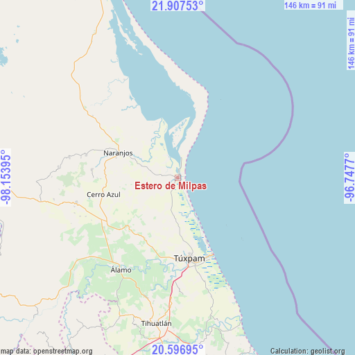
Estero de Milpas GPS coordinates[2]
21° 15' 13.32" North, 97° 27' 2.952" West
| Map corner | latitude | longitude |
|---|---|---|
| Upper-left | 21.90753°, | -98.15395° |
| Center: | 21.2537°, | -97.45082° |
| Lower-right: | 20.59695°, | -96.7477° |
| Map W x H: | 145.7×145.7 km | = 90.5×90.5mi |
| max Lat: | 32.7° ⇑20.4% North |
| Estero de Milpas: | 21.2537° |
| min Lat: | ⇓79.6% South 14.53588° |
| min Long | Estero de Milpa | max Long |
| -117.105° | -97.45082° | -86.73105° |
| W 70%⇐ | ⇒30% E |
Elevation
Elevation of Estero de Milpas is 6 m = 20 ft, and this is 1247.7 m = 4094 ft below average elevation for this country.
| Max E: |
3497 m = 11473 ft | 99.1% |
| Avg. | 1253.7 m = 4113 ft | |
| Estero de Milpas | 6 m = 20 ft | |
Min E: |
-1 m = -3 ft | 0.9% |
See also: Mexico elevation on elevation.city.
Geographical zone
Estero de Milpas is located in North Torrid zone (between Equator and Tropic of Cancer). Distance of this Northern Tropic circle is 242.7 km =150.8 mi to North.| Distance of | km | miles | from Estero de Milpas |
|---|---|---|---|
| North Pole | 7643.9 | 4749.7 | to North |
| Arctic Circle | 5038 | 3130.5 | to North |
| Tropic Cancer | 242.7 | 150.8 | to North |
| Equator | 2363.2 | 1468.4 | to South |


Nearby cities:
15 places around Estero de Milpas: (largest is in red/bold)
• Cervantes
28.1 km =17.5 mi,  288°
288°
• Chalahuite
23.3 km =14.5 mi,  205°
205°
• Colonia las Flores
27.8 km =17.3 mi,  295°
295°
• El Anono
21.3 km =13.2 mi,  270°
270°
• El Cafetal
22 km =13.7 mi,  253°
253°
• Galeana
25.2 km =15.7 mi,  279°
279°
• La Pimienta
20.6 km =12.8 mi, 304°
• La Reforma
20.5 km =12.7 mi,  333°
333°
• Naranjos
26.7 km =16.6 mi, 293°
• Palo Blanco
5.7 km =3.5 mi,  15°
15°
• Rancho Nuevo
24.7 km =15.3 mi, 291°
• Saladero
21.2 km =13.2 mi, 333°
• Tamiahua
2.8 km =1.7 mi,  9°
9°
• Temapache
28.8 km =17.9 mi,  223°
223°
• Zacamixtle
28.1 km =17.5 mi, 268°
Sources, notices
• [Note1] Compared only with cities in Mexico existing in our database
• [Src1] Map data: © OpenStreetMap contributors (CC-BY-SA)
• [Src2] Other city data from geonames.org with taken over terms of usage.
• [Src3] Geographical zone / Annual Mean Temperature by Robert A. Rohde @ Wikipedia
