Pisaflores geodata
Pisaflores (Veracruz) is a populated place; located in Mexico in America/Mexico_City (GMT-6) time zone. With population of 2,324 people, there are 3798 cities with bigger population in this country. Compared to other cities in Mexico, 70.2% of cities are located further ↓South; 64.5% of cities are located further ←West and 75.9% of cities have higher elevation than Pisaflores. Note1


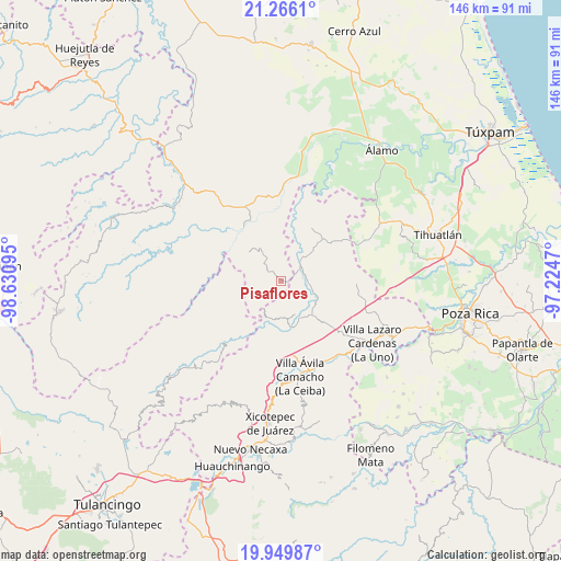
Pisaflores GPS coordinates[2]
20° 36' 33.876" North, 97° 55' 40.152" West
| Map corner | latitude | longitude |
|---|---|---|
| Upper-left | 21.2661°, | -98.63095° |
| Center: | 20.60941°, | -97.92782° |
| Lower-right: | 19.94987°, | -97.2247° |
| Map W x H: | 146.4×146.4 km | = 91×91mi |
| max Lat: | 32.7° ⇑29.8% North |
| Pisaflores: | 20.60941° |
| min Lat: | ⇓70.2% South 14.53588° |
| min Long | Pisaflores | max Long |
| -117.105° | -97.92782° | -86.73105° |
| W 64.5%⇐ | ⇒35.5% E |
Elevation
Elevation of Pisaflores is 189 m = 620 ft, and this is 1064.7 m = 3493 ft below average elevation for this country.
| Max E: |
3497 m = 11473 ft | 75.9% |
| Avg. | 1253.7 m = 4113 ft | |
| Pisaflores | 189 m = 620 ft | |
Min E: |
-1 m = -3 ft | 24.1% |
See also: Mexico elevation on elevation.city.
Geographical zone
Pisaflores is located in North Torrid zone (between Equator and Tropic of Cancer). Distance of this Northern Tropic circle is 314.4 km =195.4 mi to North.| Distance of | km | miles | from Pisaflores |
|---|---|---|---|
| North Pole | 7715.5 | 4794.2 | to North |
| Arctic Circle | 5109.6 | 3175 | to North |
| Tropic Cancer | 314.4 | 195.4 | to North |
| Equator | 2291.6 | 1423.9 | to South |


Nearby cities:
15 places around Pisaflores: (largest is in red/bold)
• Agua Linda
6.9 km =4.3 mi,  111°
111°
• Ejido Carrizal Viejo
10.9 km =6.8 mi,  152°
152°
• Ejido Cañada Colotla
4.9 km =3 mi,  168°
168°
• El Pozo
11.5 km =7.1 mi,  203°
203°
• El Tepetate
3.2 km =2 mi, 173°
• El Zapote Bravo
9.4 km =5.8 mi,  308°
308°
• Ixtololoya
10.3 km =6.4 mi, 202°
• Jaltocan
11.5 km =7.1 mi,  84°
84°
• Juntas Chicas
11.4 km =7.1 mi,  249°
249°
• La Pahua
7.7 km =4.8 mi,  88°
88°
• Ojital Cuayo
11.7 km =7.3 mi,  343°
343°
• Pantepec
9.8 km =6.1 mi,  186°
186°
• Progreso de Allende
3.5 km =2.2 mi,  70°
70°
• San Francisco
10 km =6.2 mi,  230°
230°
• San Martín
9.6 km =6 mi,  353°
353°
Sources, notices
• [Note1] Compared only with cities in Mexico existing in our database
• [Src1] Map data: © OpenStreetMap contributors (CC-BY-SA)
• [Src2] Other city data from geonames.org with taken over terms of usage.
• [Src3] Geographical zone / Annual Mean Temperature by Robert A. Rohde @ Wikipedia
