Juntas Chicas geodata
Juntas Chicas (Hidalgo) is a populated place; located in Mexico in America/Mexico_City (GMT-6) time zone. With population of 876 people, there are 9971 cities with bigger population in this country. Compared to other cities in Mexico, 69.4% of cities are located further ↓South; 63.3% of cities are located further ←West and 72.9% of cities have higher elevation than Juntas Chicas. Note1


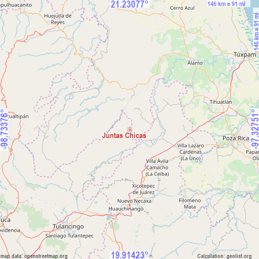
Juntas Chicas GPS coordinates[2]
20° 34' 26.112" North, 98° 1' 50.268" West
| Map corner | latitude | longitude |
|---|---|---|
| Upper-left | 21.23077°, | -98.73376° |
| Center: | 20.57392°, | -98.03063° |
| Lower-right: | 19.91423°, | -97.32751° |
| Map W x H: | 146.4×146.4 km | = 91×91mi |
| max Lat: | 32.7° ⇑30.6% North |
| Juntas Chicas: | 20.57392° |
| min Lat: | ⇓69.4% South 14.53588° |
| min Long | Juntas Chicas | max Long |
| -117.105° | -98.03063° | -86.73105° |
| W 63.3%⇐ | ⇒36.7% E |
Elevation
Elevation of Juntas Chicas is 293 m = 961 ft, and this is 960.7 m = 3152 ft below average elevation for this country.
| Max E: |
3497 m = 11473 ft | 72.9% |
| Avg. | 1253.7 m = 4113 ft | |
| Juntas Chicas | 293 m = 961 ft | |
Min E: |
-1 m = -3 ft | 27.1% |
See also: Mexico elevation on elevation.city.
Geographical zone
Juntas Chicas is located in North Torrid zone (between Equator and Tropic of Cancer). Distance of this Northern Tropic circle is 318.3 km =197.8 mi to North.| Distance of | km | miles | from Juntas Chicas |
|---|---|---|---|
| North Pole | 7719.5 | 4796.7 | to North |
| Arctic Circle | 5113.6 | 3177.4 | to North |
| Tropic Cancer | 318.3 | 197.8 | to North |
| Equator | 2287.6 | 1421.4 | to South |


Nearby cities:
15 places around Juntas Chicas: (largest is in red/bold)
• Acuautla
9.3 km =5.8 mi,  182°
182°
• Ejido Cañada Colotla
11.7 km =7.3 mi,  94°
94°
• El Pozo
8.9 km =5.5 mi,  137°
137°
• El Tepetate
11.1 km =6.9 mi, 86°
• El Zapote Bravo
10.3 km =6.4 mi,  18°
18°
• Ixhuatlán de Madero
12.9 km =8 mi,  8°
8°
• Ixtololoya
8.8 km =5.5 mi,  129°
129°
• Pantepec
11.2 km =7 mi,  121°
121°
• Pisaflores
11.4 km =7.1 mi,  69°
69°
• San Ambrosio
5.2 km =3.2 mi,  169°
169°
• San Andrés
10.5 km =6.5 mi,  220°
220°
• San Esteban
4.5 km =2.8 mi, 223°
• San Francisco
3.8 km =2.4 mi, 128°
• San Gregorio
8.5 km =5.3 mi, 171°
• San Lorenzo Achiotepec
4.7 km =2.9 mi,  303°
303°
Sources, notices
• [Note1] Compared only with cities in Mexico existing in our database
• [Src1] Map data: © OpenStreetMap contributors (CC-BY-SA)
• [Src2] Other city data from geonames.org with taken over terms of usage.
• [Src3] Geographical zone / Annual Mean Temperature by Robert A. Rohde @ Wikipedia
