San Francisco geodata
San Francisco (Veracruz) is a populated place; located in Mexico in America/Mexico_City (GMT-6) time zone. With population of 3,353 people, there are 2708 cities with bigger population in this country. Compared to other cities in Mexico, 69% of cities are located further ↓South; 63.6% of cities are located further ←West and 65.8% of cities have higher elevation than San Francisco. Note1


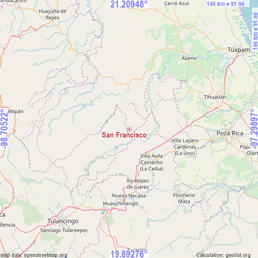
San Francisco GPS coordinates[2]
20° 33' 9.144" North, 98° 0' 7.524" West
| Map corner | latitude | longitude |
|---|---|---|
| Upper-left | 21.20948°, | -98.70522° |
| Center: | 20.55254°, | -98.00209° |
| Lower-right: | 19.89276°, | -97.29897° |
| Map W x H: | 146.4×146.4 km | = 91×91mi |
| max Lat: | 32.7° ⇑31% North |
| San Francisco: | 20.55254° |
| min Lat: | ⇓69% South 14.53588° |
| min Long | San Francisco | max Long |
| -117.105° | -98.00209° | -86.73105° |
| W 63.6%⇐ | ⇒36.4% E |
Elevation
Elevation of San Francisco is 644 m = 2113 ft, and this is 609.7 m = 2000 ft below average elevation for this country.
| Max E: |
3497 m = 11473 ft | 65.8% |
| Avg. | 1253.7 m = 4113 ft | |
| San Francisco | 644 m = 2113 ft | |
Min E: |
-1 m = -3 ft | 34.2% |
See also: Mexico elevation on elevation.city.
Geographical zone
San Francisco is located in North Torrid zone (between Equator and Tropic of Cancer). Distance of this Northern Tropic circle is 320.7 km =199.3 mi to North.| Distance of | km | miles | from San Francisco |
|---|---|---|---|
| North Pole | 7721.8 | 4798.1 | to North |
| Arctic Circle | 5115.9 | 3178.9 | to North |
| Tropic Cancer | 320.7 | 199.3 | to North |
| Equator | 2285.2 | 1420 | to South |


Nearby cities:
15 places around San Francisco: (largest is in red/bold)
• Acuautla
7.7 km =4.8 mi,  205°
205°
• Ejido Cañada Colotla
8.8 km =5.5 mi,  80°
80°
• El Pozo
5.2 km =3.2 mi,  144°
144°
• El Tepetate
8.7 km =5.4 mi,  68°
68°
• El Zapote Bravo
12.2 km =7.6 mi,  1°
1°
• Ixtololoya
5 km =3.1 mi,  129°
129°
• Juntas Chicas
3.8 km =2.4 mi,  308°
308°
• Pantepec
7.4 km =4.6 mi,  117°
117°
• Pisaflores
10 km =6.2 mi,  50°
50°
• San Ambrosio
3.4 km =2.1 mi,  216°
216°
• San Andrés
11.3 km =7 mi,  240°
240°
• San Antonio el Grande
11.2 km =7 mi,  197°
197°
• San Esteban
6.1 km =3.8 mi,  261°
261°
• San Gregorio
6.3 km =3.9 mi, 195°
• San Lorenzo Achiotepec
8.5 km =5.3 mi, 305°
Sources, notices
• [Note1] Compared only with cities in Mexico existing in our database
• [Src1] Map data: © OpenStreetMap contributors (CC-BY-SA)
• [Src2] Other city data from geonames.org with taken over terms of usage.
• [Src3] Geographical zone / Annual Mean Temperature by Robert A. Rohde @ Wikipedia
