Paso del Pital geodata
Paso del Pital (Veracruz) is a populated place; located in Mexico in America/Mexico_City (GMT-6) time zone. With population of 921 people, there are 9483 cities with bigger population in this country. Compared to other cities in Mexico, 70.6% of cities are located further ↓South; 70.4% of cities are located further ←West and 87.5% of cities have higher elevation than Paso del Pital. Note1


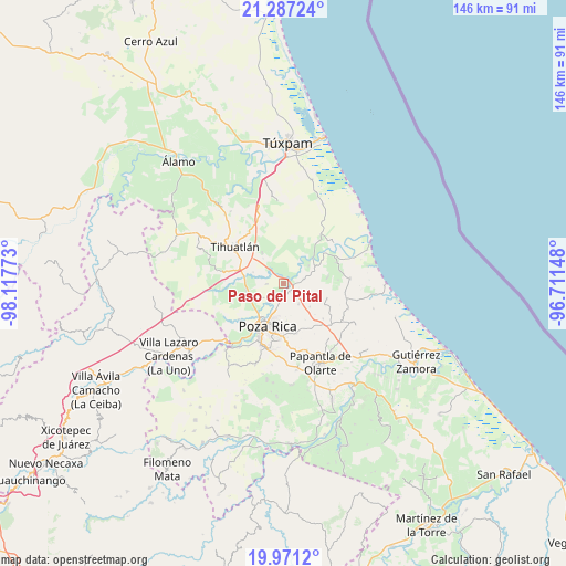
Paso del Pital GPS coordinates[2]
20° 37' 50.304" North, 97° 24' 52.56" West
| Map corner | latitude | longitude |
|---|---|---|
| Upper-left | 21.28724°, | -98.11773° |
| Center: | 20.63064°, | -97.4146° |
| Lower-right: | 19.9712°, | -96.71148° |
| Map W x H: | 146.3×146.3 km | = 90.9×90.9mi |
| max Lat: | 32.7° ⇑29.4% North |
| Paso del Pital: | 20.63064° |
| min Lat: | ⇓70.6% South 14.53588° |
| min Long | Paso del Pital | max Long |
| -117.105° | -97.4146° | -86.73105° |
| W 70.4%⇐ | ⇒29.6% E |
Elevation
Elevation of Paso del Pital is 32 m = 105 ft, and this is 1221.7 m = 4008 ft below average elevation for this country.
| Max E: |
3497 m = 11473 ft | 87.5% |
| Avg. | 1253.7 m = 4113 ft | |
| Paso del Pital | 32 m = 105 ft | |
Min E: |
-1 m = -3 ft | 12.5% |
See also: Mexico elevation on elevation.city.
Geographical zone
Paso del Pital is located in North Torrid zone (between Equator and Tropic of Cancer). Distance of this Northern Tropic circle is 312 km =193.9 mi to North.| Distance of | km | miles | from Paso del Pital |
|---|---|---|---|
| North Pole | 7713.1 | 4792.7 | to North |
| Arctic Circle | 5107.3 | 3173.5 | to North |
| Tropic Cancer | 312 | 193.9 | to North |
| Equator | 2293.9 | 1425.4 | to South |


Nearby cities:
15 places around Paso del Pital: (largest is in red/bold)
• Acontitla
6.5 km =4 mi,  28°
28°
• Colonia las Arboledas
4.5 km =2.8 mi,  193°
193°
• El Palmar
3.2 km =2 mi,  210°
210°
• El Águila
4.3 km =2.7 mi,  270°
270°
• Fraccionamiento la Florida
5.1 km =3.2 mi,  196°
196°
• La Concepción
2.4 km =1.5 mi,  35°
35°
• La Isla Km 10
9.2 km =5.7 mi,  253°
253°
• La Piedad
8.1 km =5 mi,  53°
53°
• La Victoria (Kilómetro 47)
3.8 km =2.4 mi, 192°
• Rancho Nuevo
6.9 km =4.3 mi,  224°
224°
• Residencial Tajín
3.6 km =2.2 mi,  183°
183°
• Sombrerete
9 km =5.6 mi,  111°
111°
• Vicente Herrera
9 km =5.6 mi,  131°
131°
• Villa de las Flores
6.3 km =3.9 mi, 198°
• Úrsulo Galván
4 km =2.5 mi, 219°
Sources, notices
• [Note1] Compared only with cities in Mexico existing in our database
• [Src1] Map data: © OpenStreetMap contributors (CC-BY-SA)
• [Src2] Other city data from geonames.org with taken over terms of usage.
• [Src3] Geographical zone / Annual Mean Temperature by Robert A. Rohde @ Wikipedia
