Fuerte de Anaya geodata
Fuerte de Anaya (Veracruz) is a populated place; located in Mexico in America/Mexico_City (GMT-6) time zone. With population of 693 people, there are 12564 cities with bigger population in this country. Compared to other cities in Mexico, 63.5% of cities are located further ↓South; 75.3% of cities are located further ←West and 93.5% of cities have higher elevation than Fuerte de Anaya. Note1


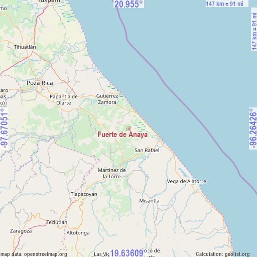
Fuerte de Anaya GPS coordinates[2]
20° 17' 49.02" North, 96° 58' 2.568" West
| Map corner | latitude | longitude |
|---|---|---|
| Upper-left | 20.955°, | -97.67051° |
| Center: | 20.29695°, | -96.96738° |
| Lower-right: | 19.63609°, | -96.26426° |
| Map W x H: | 146.6×146.7 km | = 91.1×91.2mi |
| max Lat: | 32.7° ⇑36.5% North |
| Fuerte de Anaya: | 20.29695° |
| min Lat: | ⇓63.5% South 14.53588° |
| min Long | Fuerte de Anaya | max Long |
| -117.105° | -96.96738° | -86.73105° |
| W 75.3%⇐ | ⇒24.7% E |
Elevation
Elevation of Fuerte de Anaya is 16 m = 52 ft, and this is 1237.7 m = 4061 ft below average elevation for this country.
| Max E: |
3497 m = 11473 ft | 93.5% |
| Avg. | 1253.7 m = 4113 ft | |
| Fuerte de Anaya | 16 m = 52 ft | |
Min E: |
-1 m = -3 ft | 6.5% |
See also: Mexico elevation on elevation.city.
Geographical zone
Fuerte de Anaya is located in North Torrid zone (between Equator and Tropic of Cancer). Distance of this Northern Tropic circle is 349.1 km =216.9 mi to North.| Distance of | km | miles | from Fuerte de Anaya |
|---|---|---|---|
| North Pole | 7750.3 | 4815.8 | to North |
| Arctic Circle | 5144.4 | 3196.6 | to North |
| Tropic Cancer | 349.1 | 216.9 | to North |
| Equator | 2256.8 | 1402.3 | to South |


Nearby cities:
15 places around Fuerte de Anaya: (largest is in red/bold)
• Arroyo Blanco
13.3 km =8.3 mi,  226°
226°
• Cañada Rica
14 km =8.7 mi,  278°
278°
• Cementeras del Pital
15.3 km =9.5 mi,  150°
150°
• Ejido Vega de San Marcos
11.2 km =7 mi,  164°
164°
• El Cabellal
5.9 km =3.7 mi,  205°
205°
• El Faisán
13.2 km =8.2 mi,  199°
199°
• Emiliano Zapata
6.4 km =4 mi,  172°
172°
• Hueytepec
7 km =4.3 mi,  297°
297°
• La Guadalupe
9.9 km =6.2 mi,  30°
30°
• La Vigueta
10 km =6.2 mi,  65°
65°
• Manuel Ávila Camacho
10.6 km =6.6 mi, 206°
• Monte Gordo
13.5 km =8.4 mi,  92°
92°
• Puntilla Aldama
13.5 km =8.4 mi, 152°
• Ricardo Flores Magón
9.5 km =5.9 mi,  43°
43°
• Zanjas de Arena
11.4 km =7.1 mi, 207°
Sources, notices
• [Note1] Compared only with cities in Mexico existing in our database
• [Src1] Map data: © OpenStreetMap contributors (CC-BY-SA)
• [Src2] Other city data from geonames.org with taken over terms of usage.
• [Src3] Geographical zone / Annual Mean Temperature by Robert A. Rohde @ Wikipedia
