Ricardo Flores Magón geodata
Ricardo Flores Magón (Veracruz) is a populated place; located in Mexico in America/Mexico_City (GMT-6) time zone. With population of 955 people, there are 9122 cities with bigger population in this country. Compared to other cities in Mexico, 64.7% of cities are located further ↓South; 76.1% of cities are located further ←West and 98.7% of cities have higher elevation than Ricardo Flores Magón. Note1
Current local time in Ricardo Flores Magón:
08:22 AM, WednesdayDifference from your time zone: hours


Ricardo Flores Magón GPS coordinates[2]
20° 21' 31.968" North, 96° 54' 16.2" West
| Map corner | latitude | longitude |
|---|---|---|
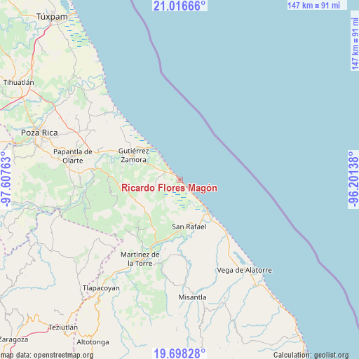
| Upper-left | 21.01666°, | -97.60763° |
| Center: | 20.35888°, | -96.9045° |
| Lower-right: | 19.69828°, | -96.20138° |
| Map W x H: | 146.6×146.6 km | = 91.1×91.1mi |
| max Lat: | 32.7° ⇑35.3% North |
| Ricardo Flores Magón: | 20.35888° |
| min Lat: | ⇓64.7% South 14.53588° |
| min Long | Ricardo Flores | max Long |
| -117.105° | -96.9045° | -86.73105° |
| W 76.1%⇐ | ⇒23.9% E |
Elevation
Elevation of Ricardo Flores Magón is 7 m = 23 ft, and this is 1246.7 m = 4090 ft below average elevation for this country.
| Max E: |
3497 m = 11473 ft | 98.7% |
| Avg. | 1253.7 m = 4113 ft | |
| Ricardo Flores Magón | 7 m = 23 ft | |
Min E: |
-1 m = -3 ft | 1.3% |
See also: Mexico elevation on elevation.city.
Geographical zone
Ricardo Flores Magón is located in North Torrid zone (between Equator and Tropic of Cancer). Distance of this Northern Tropic circle is 342.2 km =212.6 mi to North.| Distance of | km | miles | from Ricardo Flores Magón |
|---|---|---|---|
| North Pole | 7743.4 | 4811.5 | to North |
| Arctic Circle | 5137.5 | 3192.3 | to North |
| Tropic Cancer | 342.2 | 212.6 | to North |
| Equator | 2263.7 | 1406.6 | to South |


Nearby cities:
15 places around Ricardo Flores Magón: (largest is in red/bold)
• Casitas
15.8 km =9.8 mi,  136°
136°
• Cruz de los Esteros
15.1 km =9.4 mi,  306°
306°
• Ejido Vega de San Marcos
18 km =11.2 mi,  191°
191°
• El Cabellal
15.2 km =9.4 mi,  216°
216°
• Emiliano Zapata
14.4 km =8.9 mi,  203°
203°
• Fuerte de Anaya
9.5 km =5.9 mi, 223°
• Hueytepec
13.3 km =8.3 mi,  254°
254°
• La Guadalupe
2.2 km =1.4 mi,  316°
316°
• La Vigueta
3.7 km =2.3 mi, 136°
• Melchor Ocampo
19.7 km =12.2 mi,  154°
154°
• Monte Gordo
10.2 km =6.3 mi, 137°
• Nuevo Renacimiento 2000
19.4 km =12.1 mi,  296°
296°
• Puntilla Aldama
18.9 km =11.7 mi,  180°
180°
• San Rafael
19.3 km =12 mi,  168°
168°
• Tecolutla
17.6 km =10.9 mi, 320°
Sources, notices
• [Note1] Compared only with cities in Mexico existing in our database
• [Src1] Map data: © OpenStreetMap contributors (CC-BY-SA)
• [Src2] Other city data from geonames.org with taken over terms of usage.
• [Src3] Geographical zone / Annual Mean Temperature by Robert A. Rohde @ Wikipedia
