La Guadalupe geodata
La Guadalupe (Veracruz) is a populated place; located in Mexico in America/Mexico_City (GMT-6) time zone. With population of 1,255 people, there are 6897 cities with bigger population in this country. Compared to other cities in Mexico, 65% of cities are located further ↓South; 75.9% of cities are located further ←West and 97% of cities have higher elevation than La Guadalupe. Note1


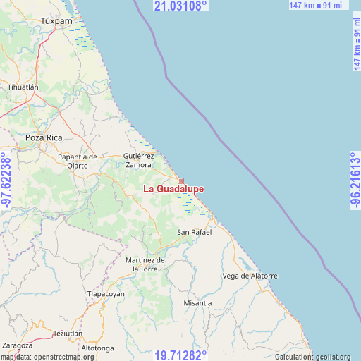
La Guadalupe GPS coordinates[2]
20° 22' 24.096" North, 96° 55' 9.3" West
| Map corner | latitude | longitude |
|---|---|---|
| Upper-left | 21.03108°, | -97.62238° |
| Center: | 20.37336°, | -96.91925° |
| Lower-right: | 19.71282°, | -96.21613° |
| Map W x H: | 146.6×146.6 km | = 91.1×91.1mi |
| max Lat: | 32.7° ⇑35% North |
| La Guadalupe: | 20.37336° |
| min Lat: | ⇓65% South 14.53588° |
| min Long | La Guadalupe | max Long |
| -117.105° | -96.91925° | -86.73105° |
| W 75.9%⇐ | ⇒24.1% E |
Elevation
Elevation of La Guadalupe is 10 m = 33 ft, and this is 1243.7 m = 4080 ft below average elevation for this country.
| Max E: |
3497 m = 11473 ft | 97% |
| Avg. | 1253.7 m = 4113 ft | |
| La Guadalupe | 10 m = 33 ft | |
Min E: |
-1 m = -3 ft | 3% |
See also: Mexico elevation on elevation.city.
Geographical zone
La Guadalupe is located in North Torrid zone (between Equator and Tropic of Cancer). Distance of this Northern Tropic circle is 340.6 km =211.6 mi to North.| Distance of | km | miles | from La Guadalupe |
|---|---|---|---|
| North Pole | 7741.8 | 4810.5 | to North |
| Arctic Circle | 5135.9 | 3191.3 | to North |
| Tropic Cancer | 340.6 | 211.6 | to North |
| Equator | 2265.3 | 1407.6 | to South |


Nearby cities:
15 places around La Guadalupe: (largest is in red/bold)
• Casitas
18 km =11.2 mi,  136°
136°
• Cañada Rica
19.9 km =12.4 mi,  251°
251°
• Cruz de los Esteros
12.9 km =8 mi,  304°
304°
• Ejido Vega de San Marcos
19.3 km =12 mi,  185°
185°
• El Cabellal
15.7 km =9.8 mi,  208°
208°
• Emiliano Zapata
15.4 km =9.6 mi,  195°
195°
• Fuerte de Anaya
9.9 km =6.2 mi, 210°
• Gutiérrez Zamora
19.5 km =12.1 mi, 297°
• Hueytepec
12.4 km =7.7 mi, 245°
• La Vigueta
5.9 km =3.7 mi, 136°
• Monte Gordo
12.4 km =7.7 mi, 136°
• Nuevo Renacimiento 2000
17.3 km =10.7 mi,  293°
293°
• Puntilla Aldama
20.5 km =12.7 mi,  176°
176°
• Ricardo Flores Magón
2.2 km =1.4 mi, 136°
• Tecolutla
15.4 km =9.6 mi,  320°
320°
Sources, notices
• [Note1] Compared only with cities in Mexico existing in our database
• [Src1] Map data: © OpenStreetMap contributors (CC-BY-SA)
• [Src2] Other city data from geonames.org with taken over terms of usage.
• [Src3] Geographical zone / Annual Mean Temperature by Robert A. Rohde @ Wikipedia
