Pueblillo geodata
Pueblillo (Veracruz) is a populated place; located in Mexico in America/Mexico_City (GMT-6) time zone. With population of 2,409 people, there are 3662 cities with bigger population in this country. Compared to other cities in Mexico, 62.6% of cities are located further ↓South; 71.9% of cities are located further ←West and 80.4% of cities have higher elevation than Pueblillo. Note1


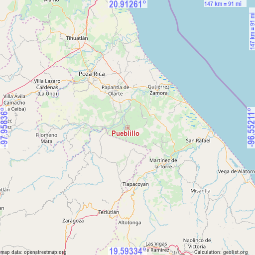
Pueblillo GPS coordinates[2]
20° 15' 15.768" North, 97° 15' 18.828" West
| Map corner | latitude | longitude |
|---|---|---|
| Upper-left | 20.91261°, | -97.95836° |
| Center: | 20.25438°, | -97.25523° |
| Lower-right: | 19.59334°, | -96.55211° |
| Map W x H: | 146.7×146.7 km | = 91.2×91.2mi |
| max Lat: | 32.7° ⇑37.4% North |
| Pueblillo: | 20.25438° |
| min Lat: | ⇓62.6% South 14.53588° |
| min Long | Pueblillo | max Long |
| -117.105° | -97.25523° | -86.73105° |
| W 71.9%⇐ | ⇒28.1% E |
Elevation
Elevation of Pueblillo is 89 m = 292 ft, and this is 1164.7 m = 3821 ft below average elevation for this country.
| Max E: |
3497 m = 11473 ft | 80.4% |
| Avg. | 1253.7 m = 4113 ft | |
| Pueblillo | 89 m = 292 ft | |
Min E: |
-1 m = -3 ft | 19.6% |
See also: Mexico elevation on elevation.city.
Geographical zone
Pueblillo is located in North Torrid zone (between Equator and Tropic of Cancer). Distance of this Northern Tropic circle is 353.8 km =219.8 mi to North.| Distance of | km | miles | from Pueblillo |
|---|---|---|---|
| North Pole | 7755 | 4818.7 | to North |
| Arctic Circle | 5149.1 | 3199.5 | to North |
| Tropic Cancer | 353.8 | 219.8 | to North |
| Equator | 2252.1 | 1399.4 | to South |


Nearby cities:
15 places around Pueblillo: (largest is in red/bold)
• Belisario Domínguez
6.8 km =4.2 mi,  227°
227°
• Cuyuxquihui
3.3 km =2.1 mi,  15°
15°
• El Cedral
8.4 km =5.2 mi,  268°
268°
• Francisco I. Madero
10.9 km =6.8 mi,  52°
52°
• Ignacio Allende
9.1 km =5.7 mi,  42°
42°
• Insurgente Socialista
7.4 km =4.6 mi,  185°
185°
• Joloapan
2.9 km =1.8 mi, 233°
• La Isla
10 km =6.2 mi,  3°
3°
• Mizantecatl
11.2 km =7 mi,  318°
318°
• Pajasco Limonar
10.4 km =6.5 mi,  275°
275°
• Paso de Valencia
8.4 km =5.2 mi, 283°
• Paso del Correo
7.1 km =4.4 mi,  345°
345°
• Rafael Rosas
12.3 km =7.6 mi, 40°
• San Lorenzo
11.2 km =7 mi, 323°
• Valsequíllo
9.1 km =5.7 mi,  164°
164°
Sources, notices
• [Note1] Compared only with cities in Mexico existing in our database
• [Src1] Map data: © OpenStreetMap contributors (CC-BY-SA)
• [Src2] Other city data from geonames.org with taken over terms of usage.
• [Src3] Geographical zone / Annual Mean Temperature by Robert A. Rohde @ Wikipedia
