Ignacio López Rayón geodata
Ignacio López Rayón (Veracruz) is a populated place; located in Mexico in America/Mexico_City (GMT-6) time zone. With population of 565 people, there are 15122 cities with bigger population in this country. Compared to other cities in Mexico, 83.1% of cities are located further ↑North; 86% of cities are located further ←West and 87.5% of cities have higher elevation than Ignacio López Rayón. Note1


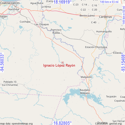
Ignacio López Rayón GPS coordinates[2]
17° 29' 59.496" North, 93° 51' 25.92" West
| Map corner | latitude | longitude |
|---|---|---|
| Upper-left | 18.16919°, | -94.56033° |
| Center: | 17.49986°, | -93.8572° |
| Lower-right: | 16.82805°, | -93.15408° |
| Map W x H: | 149.1×149.1 km | = 92.6×92.6mi |
| max Lat: | 32.7° ⇑83.1% North |
| Ignacio López Rayón: | 17.49986° |
| min Lat: | ⇓16.9% South 14.53588° |
| min Long | Ignacio López | max Long |
| -117.105° | -93.8572° | -86.73105° |
| W 86%⇐ | ⇒14% E |
Elevation
Elevation of Ignacio López Rayón is 32 m = 105 ft, and this is 1221.7 m = 4008 ft below average elevation for this country.
| Max E: |
3497 m = 11473 ft | 87.5% |
| Avg. | 1253.7 m = 4113 ft | |
| Ignacio López Rayón | 32 m = 105 ft | |
Min E: |
-1 m = -3 ft | 12.5% |
See also: Mexico elevation on elevation.city.
Geographical zone
Ignacio López Rayón is located in North Torrid zone (between Equator and Tropic of Cancer). Distance of this Northern Tropic circle is 660.1 km =410.2 mi to North.| Distance of | km | miles | from Ignacio López Rayón |
|---|---|---|---|
| North Pole | 8061.3 | 5009.1 | to North |
| Arctic Circle | 5455.4 | 3389.8 | to North |
| Tropic Cancer | 660.1 | 410.2 | to North |
| Equator | 1945.8 | 1209.1 | to South |


Nearby cities:
15 places around Ignacio López Rayón: (largest is in red/bold)
• Amatán
31 km =19.3 mi,  143°
143°
• Benito Juárez
24.7 km =15.3 mi,  42°
42°
• Chimalapa 2da. Sección
26 km =16.2 mi,  112°
112°
• Economía
30.9 km =19.2 mi,  62°
62°
• Felipe Ángeles
21.2 km =13.2 mi,  174°
174°
• Francisco Martínez Gaytán
30.4 km =18.9 mi,  8°
8°
• Graciano Sánchez
4.7 km =2.9 mi,  277°
277°
• José María Morelos y Pavón
36.3 km =22.6 mi,  77°
77°
• José María Pino Suárez 1ra. Sección
35.2 km =21.9 mi, 38°
• Licenciado Luis Echeverría Álvarez (Playa Santa)
29.1 km =18.1 mi,  134°
134°
• Manuel Sánchez Mármol
31.8 km =19.8 mi,  26°
26°
• Nueva Esperanza
32.5 km =20.2 mi,  269°
269°
• Nueva Tabasqueña
15.2 km =9.4 mi, 279°
• Pedregal Moctezuma 2da. Sección (Leyva)
28.7 km =17.8 mi, 58°
• Rómulo Calzada (La Herradura)
36.7 km =22.8 mi,  118°
118°
Sources, notices
• [Note1] Compared only with cities in Mexico existing in our database
• [Src1] Map data: © OpenStreetMap contributors (CC-BY-SA)
• [Src2] Other city data from geonames.org with taken over terms of usage.
• [Src3] Geographical zone / Annual Mean Temperature by Robert A. Rohde @ Wikipedia
