Graciano Sánchez geodata
Graciano Sánchez (Veracruz) is a populated place; located in Mexico in America/Mexico_City (GMT-6) time zone. With population of 556 people, there are 15345 cities with bigger population in this country. Compared to other cities in Mexico, 83.1% of cities are located further ↑North; 85.9% of cities are located further ←West and 88% of cities have higher elevation than Graciano Sánchez. Note1


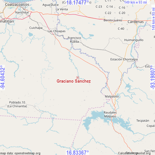
Graciano Sánchez GPS coordinates[2]
17° 30' 19.656" North, 93° 54' 4.284" West
| Map corner | latitude | longitude |
|---|---|---|
| Upper-left | 18.17477°, | -94.60432° |
| Center: | 17.50546°, | -93.90119° |
| Lower-right: | 16.83367°, | -93.19807° |
| Map W x H: | 149.1×149.1 km | = 92.6×92.6mi |
| max Lat: | 32.7° ⇑83.1% North |
| Graciano Sánchez: | 17.50546° |
| min Lat: | ⇓16.9% South 14.53588° |
| min Long | Graciano Sánch | max Long |
| -117.105° | -93.90119° | -86.73105° |
| W 85.9%⇐ | ⇒14.1% E |
Elevation
Elevation of Graciano Sánchez is 30 m = 98 ft, and this is 1223.7 m = 4015 ft below average elevation for this country.
| Max E: |
3497 m = 11473 ft | 88% |
| Avg. | 1253.7 m = 4113 ft | |
| Graciano Sánchez | 30 m = 98 ft | |
Min E: |
-1 m = -3 ft | 12% |
See also: Mexico elevation on elevation.city.
Geographical zone
Graciano Sánchez is located in North Torrid zone (between Equator and Tropic of Cancer). Distance of this Northern Tropic circle is 659.5 km =409.8 mi to North.| Distance of | km | miles | from Graciano Sánchez |
|---|---|---|---|
| North Pole | 8060.6 | 5008.6 | to North |
| Arctic Circle | 5454.7 | 3389.4 | to North |
| Tropic Cancer | 659.5 | 409.8 | to North |
| Equator | 1946.4 | 1209.4 | to South |


Nearby cities:
15 places around Graciano Sánchez: (largest is in red/bold)
• Adalberto Tejeda
35.9 km =22.3 mi,  283°
283°
• Amatán
34.4 km =21.4 mi,  138°
138°
• Benito Juárez
27.6 km =17.1 mi,  50°
50°
• Chimalapa 2da. Sección
30.5 km =19 mi,  110°
110°
• Economía
34.8 km =21.6 mi,  66°
66°
• Felipe Ángeles
22.7 km =14.1 mi,  163°
163°
• Francisco Martínez Gaytán
30.8 km =19.1 mi,  17°
17°
• Francisco Rueda
36.2 km =22.5 mi,  354°
354°
• Ignacio López Rayón
4.7 km =2.9 mi,  97°
97°
• José María Pino Suárez 1ra. Sección
37.8 km =23.5 mi,  44°
44°
• Licenciado Luis Echeverría Álvarez (Playa Santa)
32.9 km =20.4 mi,  129°
129°
• Manuel Sánchez Mármol
33.5 km =20.8 mi,  33°
33°
• Nueva Esperanza
27.8 km =17.3 mi,  268°
268°
• Nueva Tabasqueña
10.5 km =6.5 mi, 280°
• Pedregal Moctezuma 2da. Sección (Leyva)
32.5 km =20.2 mi,  63°
63°
Sources, notices
• [Note1] Compared only with cities in Mexico existing in our database
• [Src1] Map data: © OpenStreetMap contributors (CC-BY-SA)
• [Src2] Other city data from geonames.org with taken over terms of usage.
• [Src3] Geographical zone / Annual Mean Temperature by Robert A. Rohde @ Wikipedia
