La Esmeralda geodata
La Esmeralda (Oaxaca) is a populated place; located in Mexico in America/Mexico_City (GMT-6) time zone. With population of 588 people, there are 14598 cities with bigger population in this country. Compared to other cities in Mexico, 86.9% of cities are located further ↑North; 85% of cities are located further ←West and 78.7% of cities have higher elevation than La Esmeralda. Note1


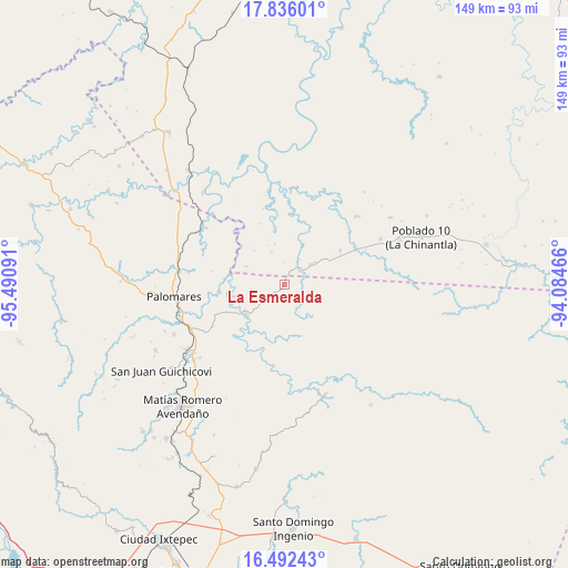
La Esmeralda GPS coordinates[2]
17° 9' 55.584" North, 94° 47' 16.008" West
| Map corner | latitude | longitude |
|---|---|---|
| Upper-left | 17.83601°, | -95.49091° |
| Center: | 17.16544°, | -94.78778° |
| Lower-right: | 16.49243°, | -94.08466° |
| Map W x H: | 149.4×149.4 km | = 92.8×92.8mi |
| max Lat: | 32.7° ⇑86.9% North |
| La Esmeralda: | 17.16544° |
| min Lat: | ⇓13.1% South 14.53588° |
| min Long | La Esmeralda | max Long |
| -117.105° | -94.78778° | -86.73105° |
| W 85%⇐ | ⇒15% E |
Elevation
Elevation of La Esmeralda is 116 m = 381 ft, and this is 1137.7 m = 3733 ft below average elevation for this country.
| Max E: |
3497 m = 11473 ft | 78.7% |
| Avg. | 1253.7 m = 4113 ft | |
| La Esmeralda | 116 m = 381 ft | |
Min E: |
-1 m = -3 ft | 21.3% |
See also: Mexico elevation on elevation.city.
Geographical zone
La Esmeralda is located in North Torrid zone (between Equator and Tropic of Cancer). Distance of this Northern Tropic circle is 697.3 km =433.3 mi to North.| Distance of | km | miles | from La Esmeralda |
|---|---|---|---|
| North Pole | 8098.4 | 5032.1 | to North |
| Arctic Circle | 5492.6 | 3412.9 | to North |
| Tropic Cancer | 697.3 | 433.3 | to North |
| Equator | 1908.6 | 1185.9 | to South |


Nearby cities:
15 places around La Esmeralda: (largest is in red/bold)
• Boca del Monte
26.9 km =16.7 mi,  244°
244°
• Cuauhtémoc
12.6 km =7.8 mi, 235°
• Donaji
29.1 km =18.1 mi,  284°
284°
• Hermanos Cedillo
21.1 km =13.1 mi,  62°
62°
• Jorge L. Tamayo (Poblado Dos)
17.1 km =10.6 mi, 58°
• Modelo Dos Ríos
25.8 km =16 mi,  5°
5°
• Nuevo Progreso
28.1 km =17.5 mi,  263°
263°
• Palomares
29.4 km =18.3 mi, 264°
• Paso Real de Sarabia
29.3 km =18.2 mi,  249°
249°
• Paso del Moral
21.5 km =13.4 mi,  68°
68°
• Plan de Arroyo
20.7 km =12.9 mi, 64°
• Plan de San Luis
25.5 km =15.8 mi,  305°
305°
• Poblado Cinco
27.9 km =17.3 mi, 64°
• Tolosita
28.3 km =17.6 mi, 278°
• Veinticuatro
9.2 km =5.7 mi,  337°
337°
Sources, notices
• [Note1] Compared only with cities in Mexico existing in our database
• [Src1] Map data: © OpenStreetMap contributors (CC-BY-SA)
• [Src2] Other city data from geonames.org with taken over terms of usage.
• [Src3] Geographical zone / Annual Mean Temperature by Robert A. Rohde @ Wikipedia
