Guadalupe Coté geodata
Guadalupe Coté (State of Mexico) is a populated place; located in Mexico in America/Mexico_City (GMT-6) time zone. With population of 1,617 people, there are 5355 cities with bigger population in this country. Compared to other cities in Mexico, 51.7% of cities are located further ↑North; 63.8% of cities are located further →East and 96.2% of cities have lower elevation than Guadalupe Coté. Note1


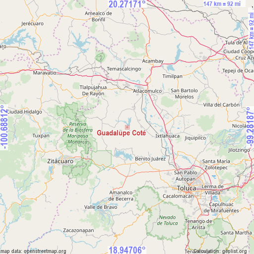
Guadalupe Coté GPS coordinates[2]
19° 36' 38.7" North, 99° 59' 5.964" West
| Map corner | latitude | longitude |
|---|---|---|
| Upper-left | 20.27171°, | -100.68812° |
| Center: | 19.61075°, | -99.98499° |
| Lower-right: | 18.94706°, | -99.28187° |
| Map W x H: | 147.3×147.3 km | = 91.5×91.5mi |
| max Lat: | 32.7° ⇑51.7% North |
| Guadalupe Coté: | 19.61075° |
| min Lat: | ⇓48.3% South 14.53588° |
| min Long | Guadalupe Coté | max Long |
| -117.105° | -99.98499° | -86.73105° |
| W 36.2%⇐ | ⇒63.8% E |
Elevation
Elevation of Guadalupe Coté is 2636 m = 8648 ft, and this is 1382.3 m = 4535 ft above average elevation for this country.
| Max E: |
3497 m = 11473 ft | 3.8% |
| Guadalupe Coté | 2636 m 8648 ft | |
| Avg. | 1253.7 m = 4113 ft | |
Min E: |
-1 m = -3 ft | 96.2% |
See also: Mexico elevation on elevation.city.
Geographical zone
Guadalupe Coté is located in North Torrid zone (between Equator and Tropic of Cancer). Distance of this Northern Tropic circle is 425.4 km =264.3 mi to North.| Distance of | km | miles | from Guadalupe Coté |
|---|---|---|---|
| North Pole | 7826.6 | 4863.2 | to North |
| Arctic Circle | 5220.7 | 3244 | to North |
| Tropic Cancer | 425.4 | 264.3 | to North |
| Equator | 2180.5 | 1354.9 | to South |


Nearby cities:
15 places around Guadalupe Coté: (largest is in red/bold)
• Barrio las Palomas, Santa Ana Nichi
3.4 km =2.1 mi,  211°
211°
• Calvario del Carmen
3.8 km =2.4 mi,  316°
316°
• Ejido la Virgen
7.3 km =4.5 mi,  257°
257°
• Estutempan
4.5 km =2.8 mi,  359°
359°
• Fresno Nichi
6.2 km =3.9 mi,  142°
142°
• San Agustín Mextepec
6.6 km =4.1 mi,  68°
68°
• San Antonio Mextepec
6.2 km =3.9 mi,  37°
37°
• San Antonio de las Huertas
5.6 km =3.5 mi,  164°
164°
• San Jerónimo Bonchete
4.4 km =2.7 mi,  58°
58°
• San Jerónimo Mavatí
4.2 km =2.6 mi,  99°
99°
• San Juan Cote Ejido
2.8 km =1.7 mi, 102°
• San Nicolás Guadalupe
4.8 km =3 mi,  274°
274°
• Santa Ana Nichi Ejido
3 km =1.9 mi,  188°
188°
• Santa Cruz Mextepec
6.4 km =4 mi,  31°
31°
• Tres Estrellas
4.8 km =3 mi,  236°
236°
Sources, notices
• [Note1] Compared only with cities in Mexico existing in our database
• [Src1] Map data: © OpenStreetMap contributors (CC-BY-SA)
• [Src2] Other city data from geonames.org with taken over terms of usage.
• [Src3] Geographical zone / Annual Mean Temperature by Robert A. Rohde @ Wikipedia
