Santa Rosa de Gallinas geodata
Santa Rosa de Gallinas (San Luis Potosí) is a populated place; located in Mexico in America/Mexico_City (GMT-6) time zone. With population of 935 people, there are 9320 cities with bigger population in this country. Compared to other cities in Mexico, 83.8% of cities are located further ↓South; 76.4% of cities are located further →East and 80.7% of cities have lower elevation than Santa Rosa de Gallinas. Note1


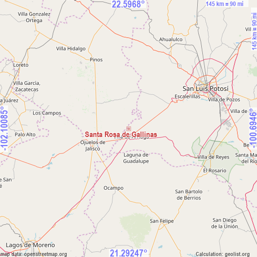
Santa Rosa de Gallinas GPS coordinates[2]
21° 56' 46.068" North, 101° 23' 51.792" West
| Map corner | latitude | longitude |
|---|---|---|
| Upper-left | 22.5968°, | -102.10085° |
| Center: | 21.94613°, | -101.39772° |
| Lower-right: | 21.29247°, | -100.6946° |
| Map W x H: | 145×145 km | = 90.1×90.1mi |
| max Lat: | 32.7° ⇑16.2% North |
| Santa Rosa de Gallinas: | 21.94613° |
| min Lat: | ⇓83.8% South 14.53588° |
| min Long | Santa Rosa de G | max Long |
| -117.105° | -101.39772° | -86.73105° |
| W 23.6%⇐ | ⇒76.4% E |
Elevation
Elevation of Santa Rosa de Gallinas is 2157 m = 7077 ft, and this is 903.3 m = 2964 ft above average elevation for this country.
| Max E: |
3497 m = 11473 ft | 19.3% |
| Santa Rosa de Gallinas | 2157 m 7077 ft | |
| Avg. | 1253.7 m = 4113 ft | |
Min E: |
-1 m = -3 ft | 80.7% |
See also: Mexico elevation on elevation.city.
Geographical zone
Santa Rosa de Gallinas is located in North Torrid zone (between Equator and Tropic of Cancer). Distance of this Northern Tropic circle is 165.7 km =103 mi to North.| Distance of | km | miles | from Santa Rosa de Gallinas |
|---|---|---|---|
| North Pole | 7566.9 | 4701.9 | to North |
| Arctic Circle | 4961 | 3082.6 | to North |
| Tropic Cancer | 165.7 | 103 | to North |
| Equator | 2440.2 | 1516.3 | to South |


Nearby cities:
15 places around Santa Rosa de Gallinas: (largest is in red/bold)
• Agua Gorda de los Patos
10.4 km =6.5 mi,  225°
225°
• Colonia Emiliano Zapata
13.8 km =8.6 mi,  93°
93°
• Colonia la Laborcilla
10.1 km =6.3 mi,  133°
133°
• El Sitio
19.8 km =12.3 mi,  275°
275°
• El Tepetate
17.7 km =11 mi,  65°
65°
• Jaula de Abajo
22 km =13.7 mi,  294°
294°
• Jaula de Arriba
19.4 km =12.1 mi,  301°
301°
• La Blanca (Chihuahua)
22.8 km =14.2 mi,  311°
311°
• La Estrella
17.9 km =11.1 mi,  330°
330°
• Laguna de Guadalupe
16.7 km =10.4 mi,  165°
165°
• Ojuelos de Jalisco
22 km =13.7 mi,  246°
246°
• Providencia de Guadalupe (Estancia)
14.8 km =9.2 mi,  184°
184°
• San Luis Gonzaga
17.4 km =10.8 mi,  38°
38°
• Santa Elena
11.9 km =7.4 mi, 286°
• Villa de Arriaga
4.4 km =2.7 mi,  158°
158°
Sources, notices
• [Note1] Compared only with cities in Mexico existing in our database
• [Src1] Map data: © OpenStreetMap contributors (CC-BY-SA)
• [Src2] Other city data from geonames.org with taken over terms of usage.
• [Src3] Geographical zone / Annual Mean Temperature by Robert A. Rohde @ Wikipedia
