La Estrella geodata
La Estrella (Zacatecas) is a populated place; located in Mexico in America/Mexico_City (GMT-6) time zone. With population of 776 people, there are 11259 cities with bigger population in this country. Compared to other cities in Mexico, 84.6% of cities are located further ↓South; 77.3% of cities are located further →East and 83% of cities have lower elevation than La Estrella. Note1


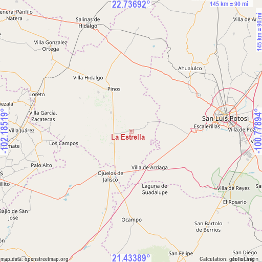
La Estrella GPS coordinates[2]
22° 5' 12.876" North, 101° 28' 55.416" West
| Map corner | latitude | longitude |
|---|---|---|
| Upper-left | 22.73692°, | -102.18519° |
| Center: | 22.08691°, | -101.48206° |
| Lower-right: | 21.43389°, | -100.77894° |
| Map W x H: | 144.9×144.9 km | = 90×90mi |
| max Lat: | 32.7° ⇑15.4% North |
| La Estrella: | 22.08691° |
| min Lat: | ⇓84.6% South 14.53588° |
| min Long | La Estrella | max Long |
| -117.105° | -101.48206° | -86.73105° |
| W 22.7%⇐ | ⇒77.3% E |
Elevation
Elevation of La Estrella is 2216 m = 7270 ft, and this is 962.3 m = 3157 ft above average elevation for this country.
| Max E: |
3497 m = 11473 ft | 17% |
| La Estrella | 2216 m 7270 ft | |
| Avg. | 1253.7 m = 4113 ft | |
Min E: |
-1 m = -3 ft | 83% |
See also: Mexico elevation on elevation.city.
Geographical zone
La Estrella is located in North Torrid zone (between Equator and Tropic of Cancer). Distance of this Northern Tropic circle is 150.1 km =93.3 mi to North.| Distance of | km | miles | from La Estrella |
|---|---|---|---|
| North Pole | 7551.2 | 4692.1 | to North |
| Arctic Circle | 4945.3 | 3072.9 | to North |
| Tropic Cancer | 150.1 | 93.3 | to North |
| Equator | 2455.8 | 1526 | to South |


Nearby cities:
15 places around La Estrella: (largest is in red/bold)
• Cieneguilla
13.9 km =8.6 mi,  22°
22°
• El Obraje
15.3 km =9.5 mi,  312°
312°
• El Sitio
17.5 km =10.9 mi,  218°
218°
• Jaula de Abajo
13.1 km =8.1 mi,  240°
240°
• Jaula de Arriba
9.6 km =6 mi,  234°
234°
• José María Morelos
7.3 km =4.5 mi,  322°
322°
• La Blanca (Chihuahua)
8.5 km =5.3 mi,  265°
265°
• La Presita
20.5 km =12.7 mi, 226°
• Presa Nueva
20.6 km =12.8 mi,  284°
284°
• San José de Castellanos
7.5 km =4.7 mi,  289°
289°
• San Luis Gonzaga
19.6 km =12.2 mi,  95°
95°
• San Martín
18.7 km =11.6 mi,  35°
35°
• Santa Elena
12.6 km =7.8 mi,  192°
192°
• Santa Rosa de Gallinas
17.9 km =11.1 mi,  150°
150°
• Villa de Arriaga
22.3 km =13.9 mi, 152°
Sources, notices
• [Note1] Compared only with cities in Mexico existing in our database
• [Src1] Map data: © OpenStreetMap contributors (CC-BY-SA)
• [Src2] Other city data from geonames.org with taken over terms of usage.
• [Src3] Geographical zone / Annual Mean Temperature by Robert A. Rohde @ Wikipedia
