Jaula de Arriba geodata
Jaula de Arriba (Zacatecas) is a populated place; located in Mexico in America/Mexico_City (GMT-6) time zone. With population of 650 people, there are 13331 cities with bigger population in this country. Compared to other cities in Mexico, 84.4% of cities are located further ↓South; 77.9% of cities are located further →East and 82% of cities have lower elevation than Jaula de Arriba. Note1


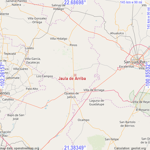
Jaula de Arriba GPS coordinates[2]
22° 2' 12.264" North, 101° 33' 30.384" West
| Map corner | latitude | longitude |
|---|---|---|
| Upper-left | 22.68698°, | -102.26157° |
| Center: | 22.03674°, | -101.55844° |
| Lower-right: | 21.38349°, | -100.85532° |
| Map W x H: | 144.9×144.9 km | = 90×90mi |
| max Lat: | 32.7° ⇑15.6% North |
| Jaula de Arriba: | 22.03674° |
| min Lat: | ⇓84.4% South 14.53588° |
| min Long | Jaula de Arriba | max Long |
| -117.105° | -101.55844° | -86.73105° |
| W 22.1%⇐ | ⇒77.9% E |
Elevation
Elevation of Jaula de Arriba is 2190 m = 7185 ft, and this is 936.3 m = 3072 ft above average elevation for this country.
| Max E: |
3497 m = 11473 ft | 18% |
| Jaula de Arriba | 2190 m 7185 ft | |
| Avg. | 1253.7 m = 4113 ft | |
Min E: |
-1 m = -3 ft | 82% |
See also: Mexico elevation on elevation.city.
Geographical zone
Jaula de Arriba is located in North Torrid zone (between Equator and Tropic of Cancer). Distance of this Northern Tropic circle is 155.7 km =96.7 mi to North.| Distance of | km | miles | from Jaula de Arriba |
|---|---|---|---|
| North Pole | 7556.8 | 4695.6 | to North |
| Arctic Circle | 4950.9 | 3076.3 | to North |
| Tropic Cancer | 155.7 | 96.7 | to North |
| Equator | 2450.3 | 1522.5 | to South |


Nearby cities:
15 places around Jaula de Arriba: (largest is in red/bold)
• El Obraje
16.3 km =10.1 mi,  348°
348°
• El Sitio
8.6 km =5.3 mi,  200°
200°
• Jaula de Abajo
3.6 km =2.2 mi,  254°
254°
• José María Morelos
11.8 km =7.3 mi,  16°
16°
• La Blanca (Chihuahua)
4.9 km =3 mi, 352°
• La Estrella
9.6 km =6 mi,  54°
54°
• La Laborcilla
18.9 km =11.7 mi,  294°
294°
• La Presita
11.1 km =6.9 mi,  220°
220°
• Matancillas (San Isidro Matancillas)
18.8 km =11.7 mi,  210°
210°
• Ojo de Agua de la Palma
17.8 km =11.1 mi,  258°
258°
• Ojuelos de Jalisco
19.3 km =12 mi,  190°
190°
• Presa Nueva
16.1 km =10 mi,  311°
311°
• San José de Castellanos
8.1 km =5 mi,  5°
5°
• Santa Elena
8.4 km =5.2 mi,  142°
142°
• Santa Rosa de Gallinas
19.4 km =12.1 mi,  121°
121°
Sources, notices
• [Note1] Compared only with cities in Mexico existing in our database
• [Src1] Map data: © OpenStreetMap contributors (CC-BY-SA)
• [Src2] Other city data from geonames.org with taken over terms of usage.
• [Src3] Geographical zone / Annual Mean Temperature by Robert A. Rohde @ Wikipedia
